
Earth from Space: Further break-up of Antarctic ice shelf
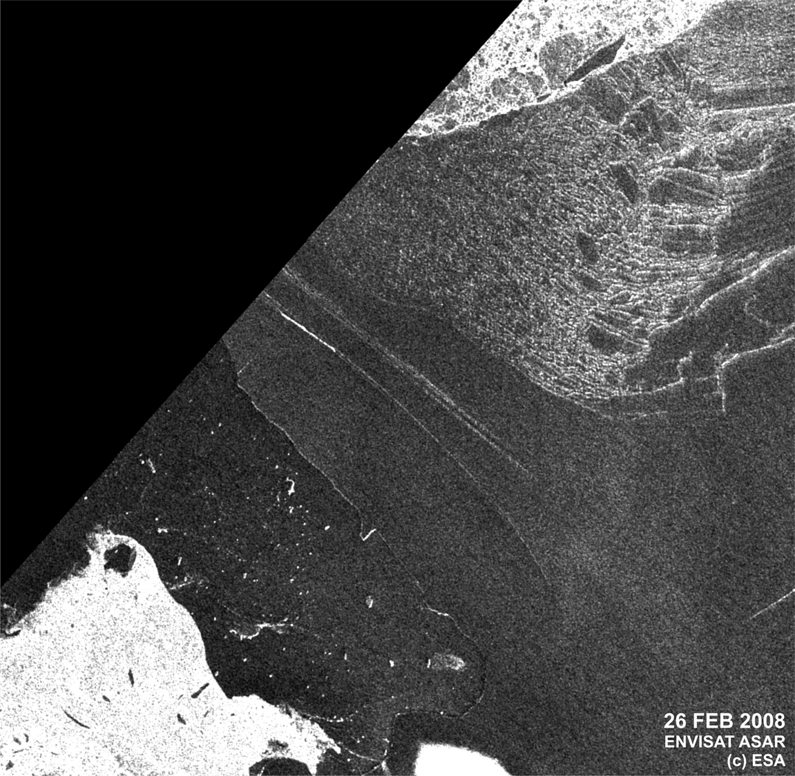
This animation, comprised of images acquired by Envisat’s Advanced Synthetic Aperture Radar (ASAR), highlights the rapid loss of ice on the Wilkins Ice Shelf from 26 February to 7 March 2008.
Between 28 and 29 February, an area of about 400 sq km disintegrated into large and small icebergs within 24 hours. The break-up was preceded by the formation of a new rift appearing first in Envisat ASAR and in Japan’s ALOS PALSAR imagery from July 2007.
As a result of the recent collapse, the remaining shelf, which totals about 14 500 sq km, is now only supported by a 6 km strip of ice. This strip is already rifted and during the recent break-up event the rift was connected to previously existing rifts on the shelf.
The Wilkins Ice Shelf is a broad plate of floating ice south of South America on the Antarctic Peninsula. Since the ice shelf is already floating, this event will not cause a rise in sea level. However, ice shelves on the Antarctic Peninsula are sandwiched by extraordinarily raising surface air temperatures and a warming ocean, making them important indicators for on-going climate change.

Thousands of years of accumulated and compacted snow on the Antarctic central plateau have formed a mighty ice sheet which flows under gravity towards the coastal plane. Along the coast the ice gradually floats on the sea – to form massive ledges known as ice shelves. But as the temperature has increased, several ice shelves have broken up and disintegrated.
Within days of its launch, Envisat captured the disintegration of the Larsen-B ice shelf in Antarctica on 18 March 2002. Scientists estimate Larsen-B had been stable since the last ice age 12 000 years ago.
ASAR is able to produce high-quality images of icebergs and ice sheets and is capable of differentiating between different types of ice because it is able to see through clouds and local darkness – conditions often found in polar areas.
These ASAR images were acquired as part of ESA’s support to the International Polar Year (IPY) 2007-2008, a large worldwide science programme focused on the Arctic and Antarctic. Matthias Braun from the Center for Remote Sensing of Land Surfaces, Bonn University, and Angelika Humbert from the Institute of Geophysics, Münster University, accessed, processed and analysed these ESA images as part of their daily IPY monitoring activities on the state of the ice sheet.
In addition to helping scientists collect an increasing amount of satellite information during IPY, ESA is also making its legacy data available through an extensive Earth Observation data portfolio containing current and historical data (dating back 15 years) from its ERS-1,

