Earth from Space: Deimos-1 delivers first images
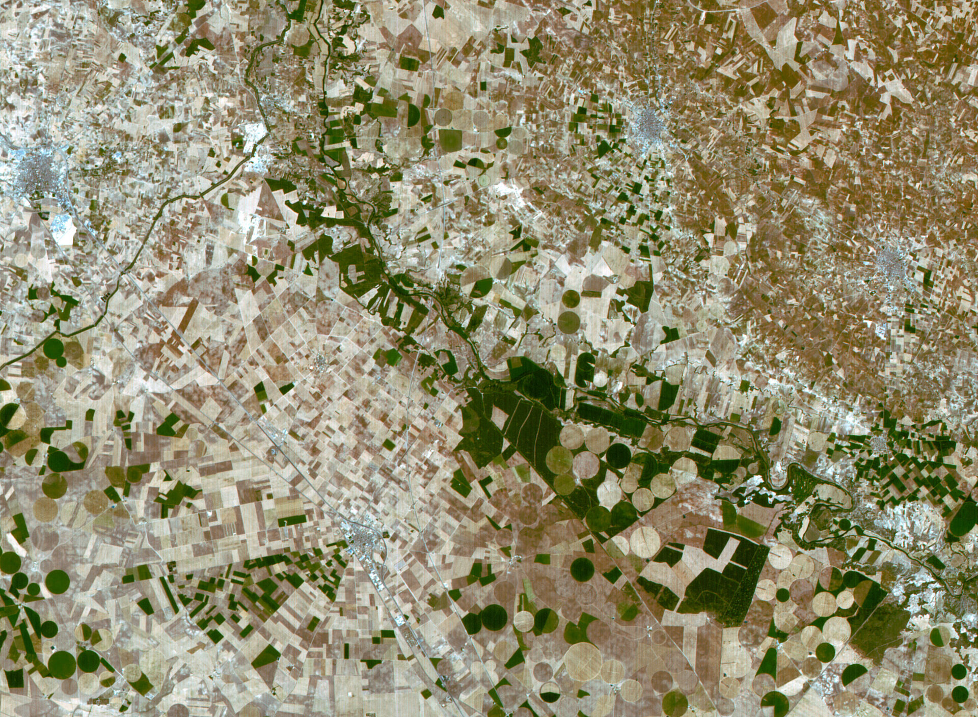
This image of vast plains and agricultural fields in central Spain was one of the first images acquired by Spain’s recently launched Deimos
Deimos-1 was launched together with Britain’s UK-DMC2 satellite from Kazakhstan on 29 July 2009. As the newest members of the Disaster Monitoring Constellation, both satellites will improve the constellation thanks to their ability to acquire larger areas (650 km) and provide sharper images (22 m) with increased depths of information. The first Deimos-1 images were acquired and processed via a ground station located in Valladolid, Spain.
Agricultural fields and urban areas (in white) are visible in this image acquired over Spain’s autonomous region of Castilla-La Mancha on 5 August. The city of La Roda is visible in the top left. As seen, industry in the area is based primarily on agriculture. The Jucar River (visible flowing southerly then easterly) has dams located on its upper and lower course to produce electricity and irrigate the coastal plains.
Circular shapes indicate centre pivot irrigation is being employed to water the fields. A well drilled in the centre of each circle supplies water to a rotating series of sprinklers which deliver water in a circular pattern, accounting for their shape.
Both Deimos-1 and UK-DMC2 satellites will be used by ESA as Contributing Missions to Global Monitoring for Environment and Security (GMES), an EU-led initiative aimed at implementing information services dealing with environment and security.
Contributing Missions play a crucial role ensuring that adequate datasets are available to the services provided by GMES. As coordinator of the GMES Space Component, ESA grants access to all GMES space data sets.
Deimos-1 and UK-DMC2 will supply the African imagery coverage requested by GMES services as well as contribute to emergency rapid mapping and burn scar mapping. The satellites will also be supported by ESA as Third Party Missions to provide scientists with data for research purposes.