
Earth from Space: Australia’s 'Red Centre'
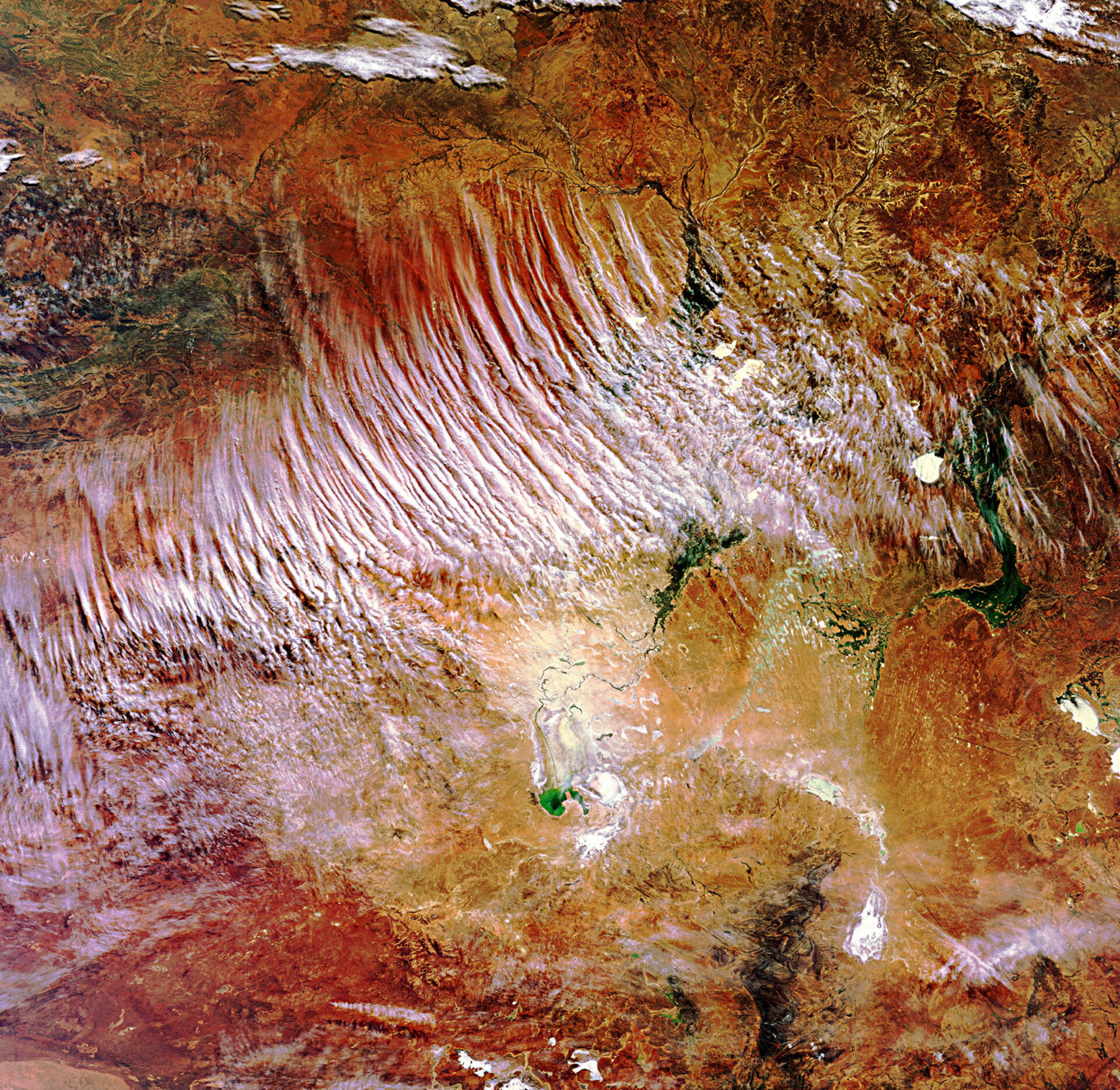
This Envisat image highlights the Lake Eyre Basin, one of the world’s largest internally draining systems, in the heart of Australia. White cloud streaks stand in contrast to the Red Centre’s vast amounts of crimson soil and sparse greenery.
The basin covers about 1.2 million sq km (about the size of France, Germany and Italy combined), including large portions of South Australia (bottom), the Northern Territory (upper left) and Queensland (upper right) and a part of western New South Wales (bottom right).
Although the rivers in this arid, barren, red region are usually dry, a series of rain events that began last year across the country’s central deserts has turned the vast floodplains around Lake Eyre (bottom centre) into wetlands.
The white circle in the centre right is Lake Yamma Yamma. To its east is Coopers Creek River, the combination of the Thomson and Barcoo Rivers. This meandering river flows roughly south through Queensland before turning due west into South Australia towards Lake Eyre.
Red earth from the Simpson Desert, the world’s largest parallel sand dune system, is visible across the top. The desert straddles the corners of South Australia, Queensland and the Northern Territory.
The vast red sands of the Yellabinna region (bottom left) and the dark sediment of the Flinders Ranges mountain range (running north to south) highlight the region’s varied landscape.
This image was acquired by Envisat’s Medium Resolution Imaging Spectrometer on 3 July 2010 at a resolution of 300 m.

