Satellite survey of Elbe flood helps Swiss Re insure for disaster
One of the worst disasters to hit Europe in the last decade has served as a case study to investigate how satellite images can improve insurance risk modelling. Following the project's end, reinsurance giant Swiss Re has added Earth Observation products to its comprehensive catastrophe database for the first time.
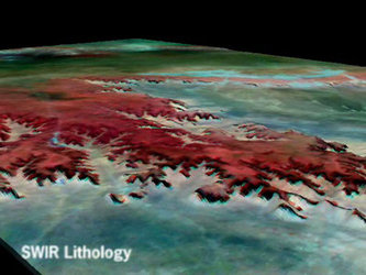
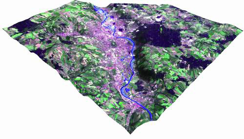
The three-week flooding of the Elbe River in August 2002 saw water levels reach 150-year highs across parts of Central and Eastern Europe. Numerous urban centres including Dresden and Prague were inundated and the resulting insurance claims were in the multi-million Euro range.
The disaster highlighted the need for enhanced river flood modelling, and with dramatic satellite images acquired during the event, led to interest in the view from above provided by Earth Observation satellites to document flood events and better assess future flood danger.

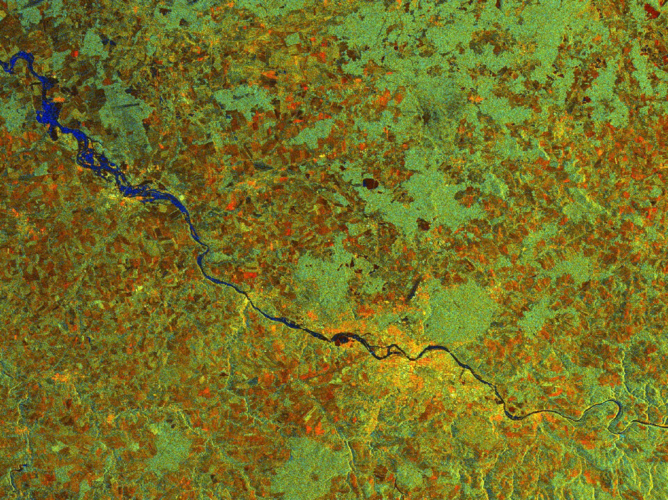
As part of an ESA Earth Observation Market Development project commencing in 2002, this catastrophic event was used as the basis of an sample exploratory service targeting the insurance sector, with two Earth Observation service companies - SERTIT in Strasbourg, France and VISTA in Munich, Germany - delivering products and services for evaluation by Swiss Re, the number two in global re-insurance.
It is common knowledge the world can be a risky place: the insurance industry has to judge precisely how risky, in order to set appropriate prices for its policies.

Accurately assessing the likelihood of household accidents or individual fires is comparatively simple. The challenge comes in setting pricing for major natural catastrophes. These disasters may take place frequently on a global basis, but occur extremely rarely within a single locality – although they cause great damage when they do, enough to potentially ruin any single direct insurance company.
That is where reinsurance firms comes in: they basically sell insurance to the insurers, taking on responsibility for catastrophic risks such as earthquakes, cyclones or floods – the latter being the world's single most costly natural disaster category.
"We underwrite insurance companies' catastrophic risks, and so we take a special interest in natural perils," said Dr. Ulruich Ebel of Swiss Re's Natural Perils research department. "We have more than 20 scientists working on different aspects of natural hazards.
"Tracing and monitoring the big events gives us a business advantage and keeps our clients and stakeholders better informed. The main questions we tackle are the likely size and magnitude of such disasters, what losses they might cause, and do we charge the right prices for the policies we sell?"
Precise cataloguing of past disasters and the insurance losses they incurred is part of their duties, but the centre also carries out risk modelling with sophisticated software systems simulating all possible events that could occur within a sufficiently long time period, stretching across thousands or tens of thousands of virtual years, to better estimate the cost of average and extreme loss burdens.
"We also make use of the actual damages claimed by direct insurances to improve risk modelling," Ebel added. "However in the aftermath of events such as the 2002 Elbe flood this requires an intense effort, very expensive for routine application.
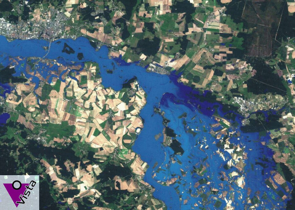
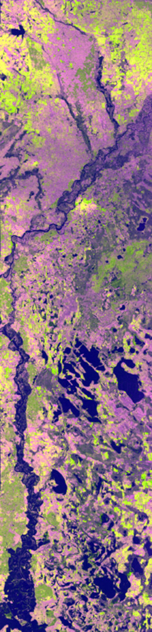
"Instead Earth Observation gives us a view of the whole extent of the flood, not only within the heavily-insured urban centres like Dresden but we can also zoom out across 400 kilometres of river to see all the affected parts of Germany. We can also trace the flood peak happening. It would take a lot of work to get the same standard of information from any other source.
"The products delivered by our project partners enable us to improve our modelling in this area. By documenting the course of the last flood we can better simulate future flood events. We can also match the images to land-use maps, and assess risk down to the scale of individual postcodes, the satellite imagery showing us what percentage of a given postcode has been flooded."
Ebel added he saw potential for Earth Observation in other areas of natural perils, giving the example of serious forest damage in Southern Sweden due to a winter storm in January this year.
Earth Observation data gathered on the Elbe flood has been added this month to Swiss Re's CatNet online database, which supplies client insurance companies and others with comprehensive information on worldwide hazards and potential risk exposure.
The activity has been carried out as part of a Flood Plain Monitoring project within ESA's EOMD Programme, aimed at strengthening European and Canadian capacities for the provision of geo-information services based mainly on Earth Observation data. To find out more about using Earth Observation for flood mapping or further opportunities with EOMD, please contact eomd@esa.int .