
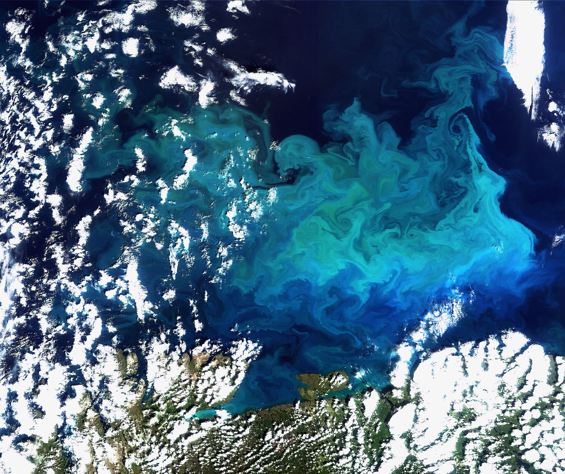
Earth from Space: Plentiful plankton
This Envisat image captures a plankton bloom larger than the country of Greece stretching across the Barents Sea off the tip of northern Europe.
The colourful blossoming bloom in the Barents Sea, a rather deep shelf sea with an average depth around 230 m, is approximately 136
Plankton, the most abundant type of life found in the ocean, are microscopic marine plants that drift on or near the surface of the sea. Microscopic plankton have been called 'the grass of the sea' because they are the basic food on which all other marine life depends.
Since plankton contain photosynthetic chlorophyll pigments, these simple organisms also play a similar role to terrestrial ‘green’ plants in the photosynthetic process. Plankton are able to convert inorganic compounds such as water, nitrogen and carbon into complex organic materials.
With their ability to 'digest' these compounds, they are credited with removing as much carbon dioxide from the atmosphere as their earthbound 'cousins'. As a result, the oceans have a profound influence on climate. Since plankton are a major influence on the amount of carbon in the atmosphere and are sensitive to environmental changes, it is important to monitor and model them into calculations of future climate change.
Although some types of plankton are individually microscopic, the chlorophyll they use for photosynthesis collectively tints the colour of the surrounding ocean waters, providing a means of detecting these tiny organisms from space with dedicated 'ocean colour' sensors, such as Envisat's Medium Resolution Imaging Spectrometer (MERIS) instrument, onboard satellites.
MERIS’s primary objective is to provide quantitative ocean-colour measurements, but the sensor has enough flexibility to serve applications in atmospheric and land-surface science as well.
MERIS acquired this image on 19 August 2009 by while working in Full Resolution mode to provide a spatial resolution of 300 m.

