
Earth from Space: Icebreaker event
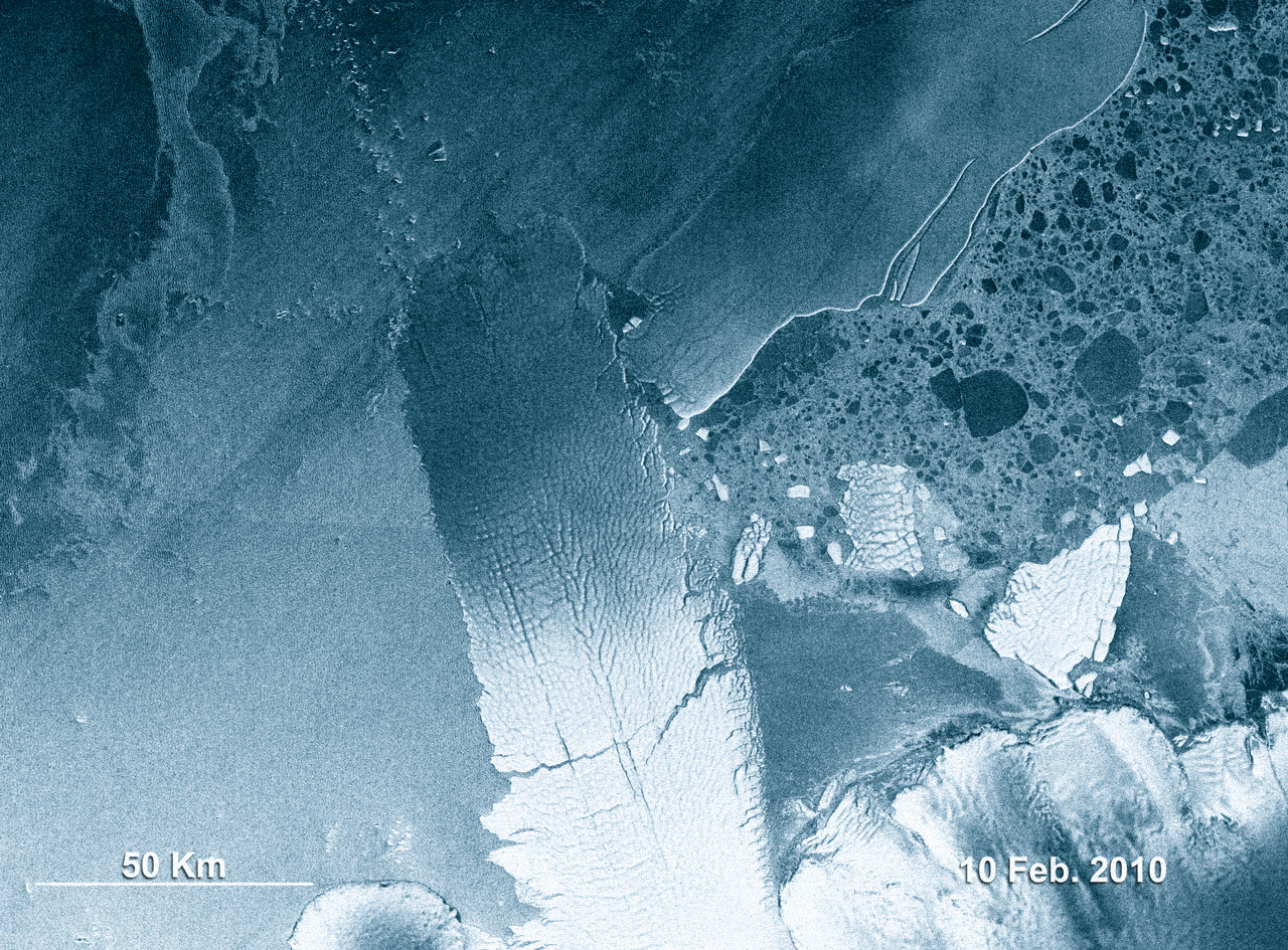
This animation, made up of eight Envisat radar images, shows the 97-km long B-9B iceberg (right) ramming into the Mertz Glacier Tongue in Eastern Antarctica in early February. The collision caused a chunk of the glacier’s tongue to snap off, giving birth to another iceberg nearly as large as B-9B.
The new iceberg, named C-28, is roughly 78-km long and 39-km wide, with a surface area of 2500 sq km (the size of Luxembourg).
Since the collision, the two icebergs have drifted together into a polynya, which is an area of open water surrounded by sea ice. Polynyas produce dense, cold, and salty water – known as 'bottom water' – that sinks to the sea bottom and drives ocean circulation.
There is concern that if the icebergs stay in the polynyas area, they could block the formation of the bottom water. This would mean less oxygen going into the deep currents that feed the oceans and would have implications for marine life in the region.
The Mertz Glacier, 72-km long and about 32-km wide, flows into the Southern Ocean off East Antarctica along the George V Coast. It forms a 160-km floating tongue that extends northward into the ocean in the general direction of Australia. The tongue had large cracks (visible) that developed years before the collision.

B-9B broke off the B9 iceberg that calved from the Ross Ice Shelf in West Antarctica in 1987. It drifted westwards and in 1992 ran aground less than 100 km to the east of the Mertz Glacier Tongue, where it has remained until last month. The image to the right shows the positions of the Mertz Glacier Tongue and the B-9B iceberg in December 2007.
The National Ice Center, located in Maryland, U.S., names icebergs that are at least 10 nautical miles (or 19 km) long and are located within a set distance from the South Pole. The names are assigned according to where and when they first broke off from a glacier or ice shelf. The first letter represents one of the four longitudinal quadrants of Antarctica ranging from A to D; quadrant A faces the southern tip of South America, while quadrant C faces Australia.
A sequential number is then assigned to the iceberg, corresponding to how many named icebergs have emerged from a particular quadrant since 1976. So, C-28 was given its name because it is the 28th iceberg to form in the C quadrant.
Envisat’s Advanced Synthetic Aperture Radar (ASAR) acquired these images from 10 February to 4 March in Wide Swath Mode, providing spatial resolution of 150 m. ASAR can pierce through clouds and local darkness and is capable of differentiating between different types of ice.

