
Earth from Space: Peaks and Plains
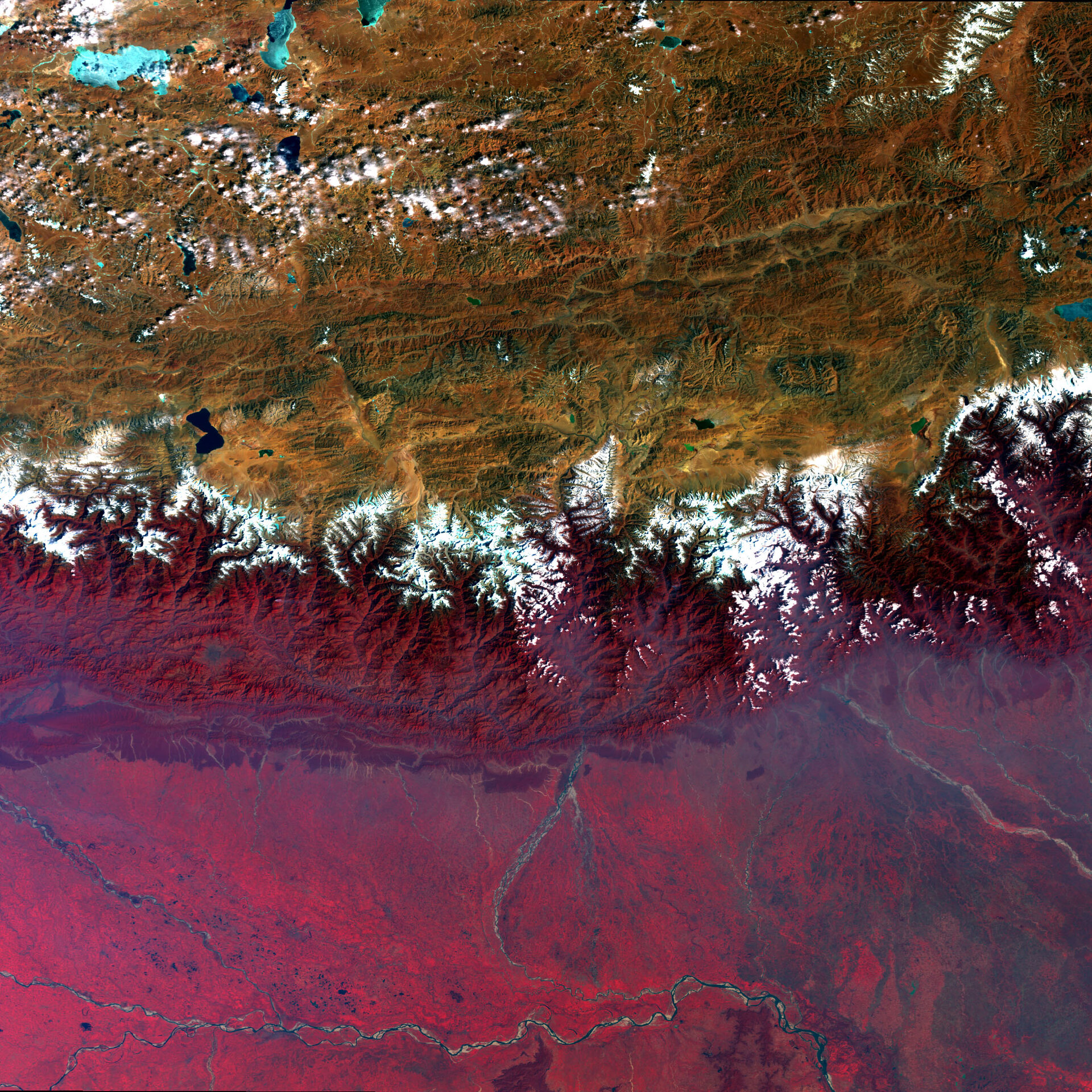
This Envisat image captures Asia’s diverse topography, altitude and climate with the snow-sprinkled Himalayan Mountains marking the barrier between the peaks of the Tibetan Plateau (top) in Central Asia and the plains of Nepal, Buthan and India in the Indian subcontinent. In this false-colour image, lush or green vegetation appears bright red.
The Tibetan Plateau was created by continental collision some 55 million years ago when the north-moving Indian Plate collided with the Eurasian Plate, causing the land to crumple and rise. And rise it did. With an average elevation exceeding 5000 m and an area of 2,5 million sq km, it is the highest and largest plateau in the world today.
The Himalayas are the world’s highest mountain range and home to the world’s highest peaks, Mt Everest (8850m) and K2 (8612m), as well as 30 other peaks over 7000 m high. Many of these peaks, including Mt Everest (located southeast of the blue boot-shaped Lake Paiku), are covered permanently with snow.
Mt Everest lies on the border between Tibet and Nepal, a trapezoid-shaped country visible in the reddish-purple Himalayan mountainous region. Its capital and largest metropolitan city, Kathmandu, is visible beneath Lake Paiku as a gray circle.
To the right of Nepal at the eastern end of the Himalayas is the Kingdom of Buthan (far right), with the narrow Indian state of Sikkim in between. The majority of the plains area in the bottom half of the image belongs to India, although a sliver of Bangladesh is visible beneath Buthan.
The Ganges River, the most important of the Indian subcontinent, is visible across the image bottom. It flows from the west through Bangladesh into the Bay of Bengal (not visible).
This image was acquired by Envisat's Medium Resolution Imaging Spectrometer (MERIS) instrument on 20 February 2009, working in Full Resolution mode to provide a spatial resolution of 300 m.

