
Earth from Space: Grand Canyon
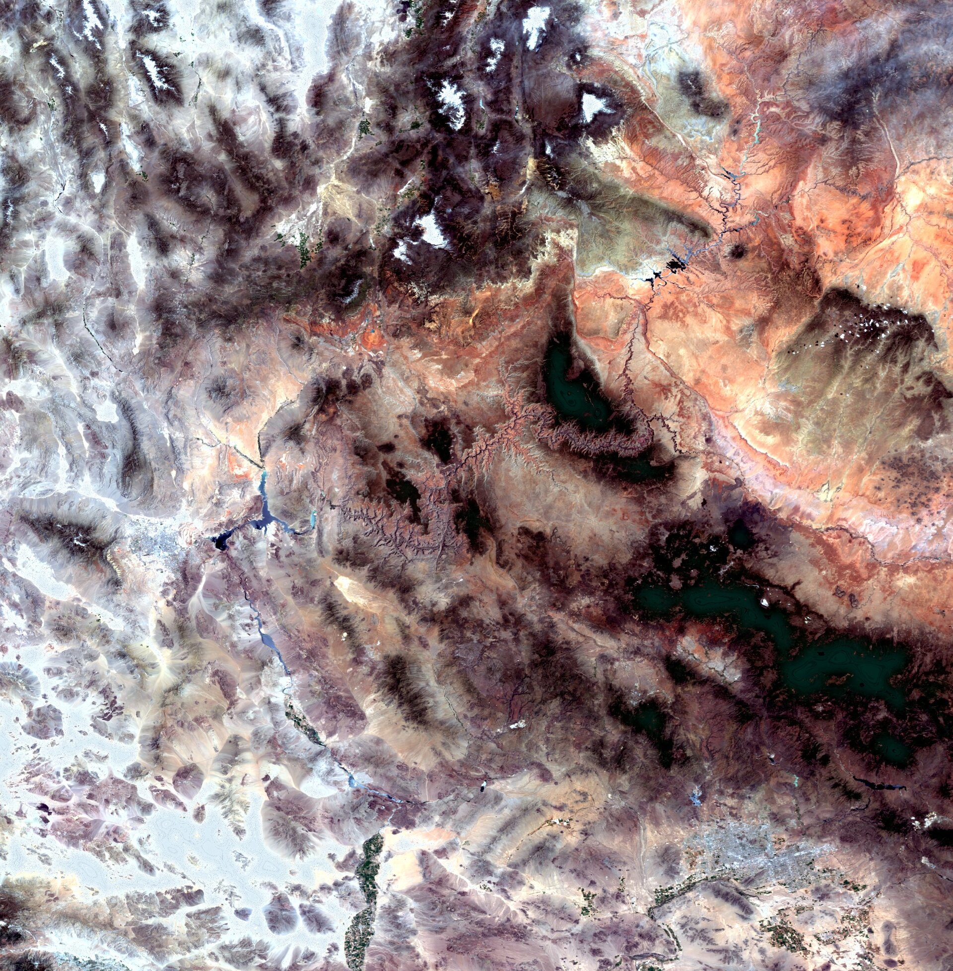
The Grand Canyon, one of the seven natural wonders of the world, is featured in this Envisat image. The canyon (the rock-like formation stretching across the centre of the image in hues of pink, violet and gray), is located in the US state of Arizona.
Canyon walls, rock structures, old lava flows, buttes, ravines, stair-step topography and brilliant colours mark its grandeur. In 1979, it was designated a UNESCO World Heritage site.
Although a number of processes combined to create the Grand Canyon, it was formed primarily by the eroding action of the Colorado River that began about six million years ago. Other contributing factors include vulcanism, continental drift and the semiarid climate.
As water erosion sculpted this majestic showplace, it revealed layers and layers of exposed rocks that provide us with a profound record of geologic events. As some of Earth’s oldest rock lies at the bottom of the canyon, it is said to be 1800 m and a billion years deep. It is about 443 km long and 8 to 29 km wide.
For thousands of years, Native American tribes inhabited the canyon. Many of their descendants, such as the Havasupai and Hualapai, continue to live in the region.
Also visible in the image are the Colorado Plateau (upper right corner), the Mogollon Plateau (dark area under Colorado Plateau), Lake Mead (Y-shaped water body left of the canyon), Las Vegas, Nevada (bright white and blue area left of Lake Mead) and the southern tip of Utah (upper left).
This image was acquired by Envisat's Medium Resolution Imaging Spectrometer (MERIS) instrument on 10 May 2009, working in Full Resolution mode to provide a spatial resolution of 300 m.

