September launch for ESA's gravity mission GOCE
A new launch date has been set for GOCE. The change of date is due to precautionary measures taken after the malfunction of an upper-stage section of a Russian Proton launcher. Now confirmed not to affect GOCE's Rockot launcher, the most advanced gravity mission to date is scheduled for lift-off on 10 September 2008.
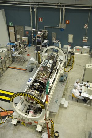
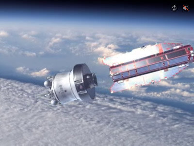
As a consequence of the new launch date, the Gravity field and steady-state Ocean Circulation Explorer (GOCE) satellite is currently undergoing final flight reconfiguration at ESA-ESTEC in the Netherlands. Shipment to the Plesetsk launch site in northern Russia will take place in July - from where the sleek five-metre long GOCE spacecraft will be carried into its unusually low orbit on a modified
SS-19 Russian Intercontinental Ballistic Missile (ICBM) launcher. The adaptation of the SS-19, called 'Rockot', uses the two original lower stages of the ICBM in conjunction with an upper-stage called Breeze-KM for commercial payloads.
Up until early March this year, GOCE was well on its way to being launched at the end of May. However, as a result of the failure on
15 March of a Proton Breeze-M upper-stage, all launches using Breeze were suspended pending investigations by the Russian State Commission. Although GOCE's Breeze-KM upper-stage is different to the larger Proton Breeze-M, they do share some common elements. The investigations have led to the conclusion that it is safe to use the Breeze-KM as is, resulting in the Russian State Commission clearing GOCE for launch.

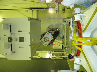
Since August last year, the high-tech GOCE spacecraft has been undergoing extensive testing at ESA's test facilities in the Netherlands. The programme included a wide range of qualification tests to ensure that the satellite could withstand the rigours of launch as well as the harsh environment of space. One such series of tests was carried out in the Large Space Simulator where, under vacuum, the extreme heat of the Sun is simulated by lamps and mirrors - subjecting the satellite to 1400 W of power over each square metre of the side of the satellite that faces the Sun.
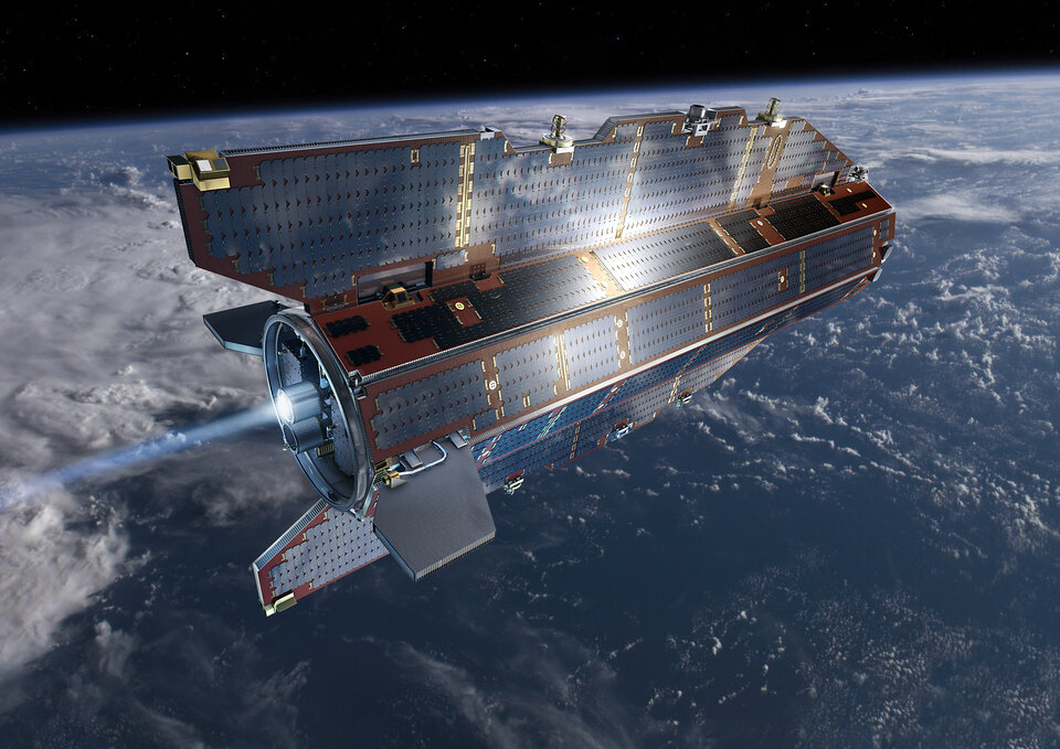
As well as being designed to fly in an orbit as low as is technically feasible to retrieve the strongest possible gravity signal, the sleek arrow-shaped satellite is ultra-stable to ensure that measurements taken are of true gravity and not influenced by any movement of the satellite. GOCE, therefore, has none of the moving parts often seen on other spacecraft. Since GOCE is designed to orbit the Earth with one side always facing the Sun, one side only is equipped with solar panels.
Due to its low altitude and inclination, once a year the GOCE satellite will experience an eclipse period of 135 days with one eclipse of up to 28 minutes per orbit. A peculiarity of orbital dynamics is that one is free to choose the eclipse period to fall either between October and February or, between April and August by launching either in the morning or in the evening of the launch day.
Now launching in September, it is best to have the eclipses in the April to August time frame. The May launch would still have gone for the eclipse season in winter. The difference in the two configurations is that, as seen from the Sun, the satellite either flies clock- or anti-clockwise around the Earth. This has impact on the satellite configuration and some units have to be moved from one side of the satellite to the other. Thanks to the flexibility of the satellite design, this is a relatively simple operation. Therefore, modifications to accommodate this new flight configuration are about to be carried out at ESA in the Netherlands. When GOCE has been reconfigured, the spacecraft will be transported by aircraft from the Netherlands to Arkhangelsk in Russia, and from there by train to the launch site in Plesetsk for final testing.
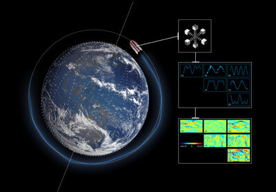
Once launched, GOCE will begin to map global variations in the gravity field with unprecedented detail and accuracy. This will result in a unique model of the geoid, which is the surface of equal gravitational potential defined by the gravity field – crucial for deriving accurate measurements of ocean circulation and sea-level change, both of which are affected by climate change. GOCE-derived data is also much needed to understand more about processes occurring inside the Earth and for use in practical applications such as surveying and levelling.