
Earth from Space: Summer ice
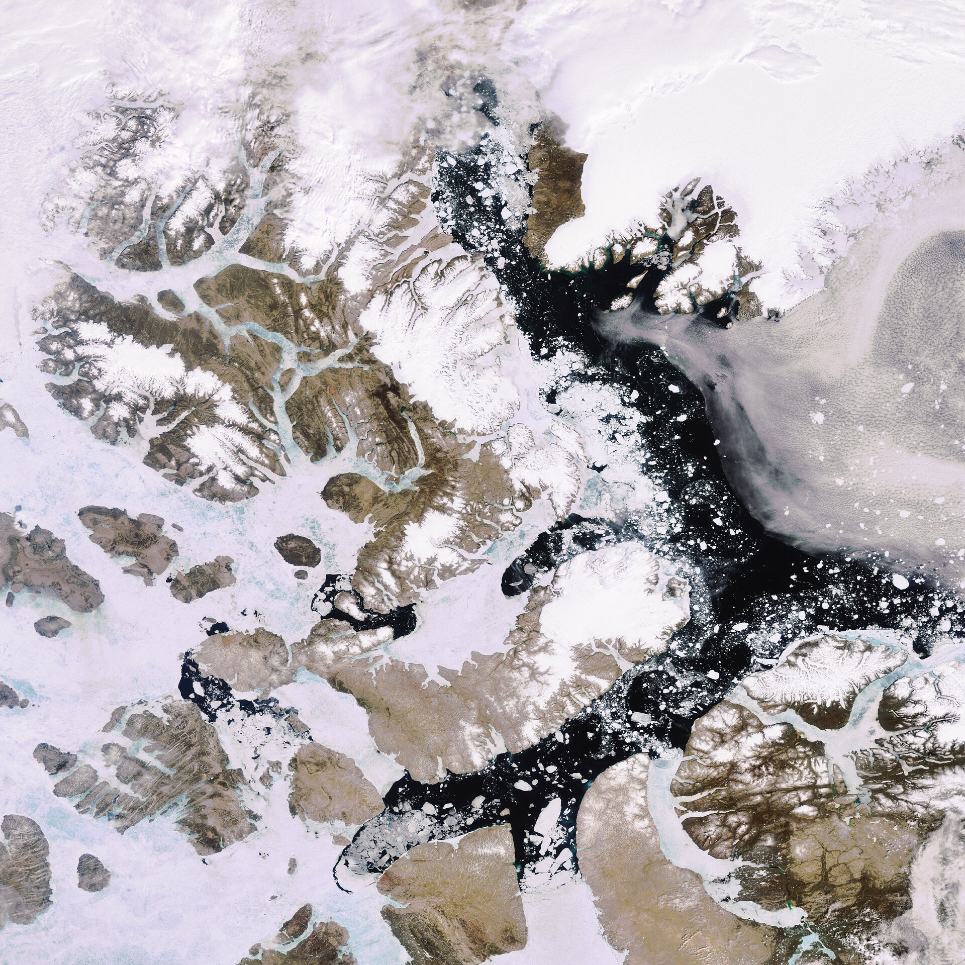
This Envisat image features the ice-connected Queen Elizabeth Islands, Baffin Island and the northwestern tip of Greenland – the world’s largest island.
The Queen Elizabeth Islands, the northernmost cluster of islands in the Canadian Arctic Archipelago, include Ellesmere (the vertical land mass to the west of the dark-blue Baffin Bay), Devon (the bean-shaped island directly beneath Ellesmere), Axel, Heiberg and the Parry (seen directly west of Devon) and Sverdrup island groups (partially visible directly southwest of Ellesmere).
The total area of land in the islands, named in honour Queen Elizabeth II, is around 419 000 sq km with about one-fifth of it covered with land ice. The largest mass of ice is on Ellesmere, the largest and northernmost island in the Canadian Arctic.
On the eastern side of Baffin Bay, or the upper right hand of the image, is northwest Greenland. The dark brown colour of Inglefield Land contrasts against the white Humboldt Glacier, the largest known glacier in the world. Visible as whiteness stretching across the upper right hand of the image, the glacier rises some 100 m and discharges into Kane Basin (located above Inglefield Land).
The Arctic sea passage between northwestern Greenland and Ellesmere Island is Smith Sound, which extends some 88 km from Baffin Bay to the Kane Basin.
Baffin Island (visible in the lower right hand corner) covers an area of some 507 451 sq km, making it the largest island in Canada and the fifth largest in the world. Baffin Island is separated from Greenland on the north and east by Baffin Bay and Davis Strait.
The crescent-shaped portion on the left is Brodeur Peninsula, separated from Borden Peninsula by the Admiralty Inlet. Bylot Island is visible just off the northeastern tip of Borden.
This image was acquired by Envisat’s Medium Resolution Imaging Spectrometer (MERIS) instrument on 2 July 2007 working in Full Resolution mode to provide a spatial resolution of 300 metres.

