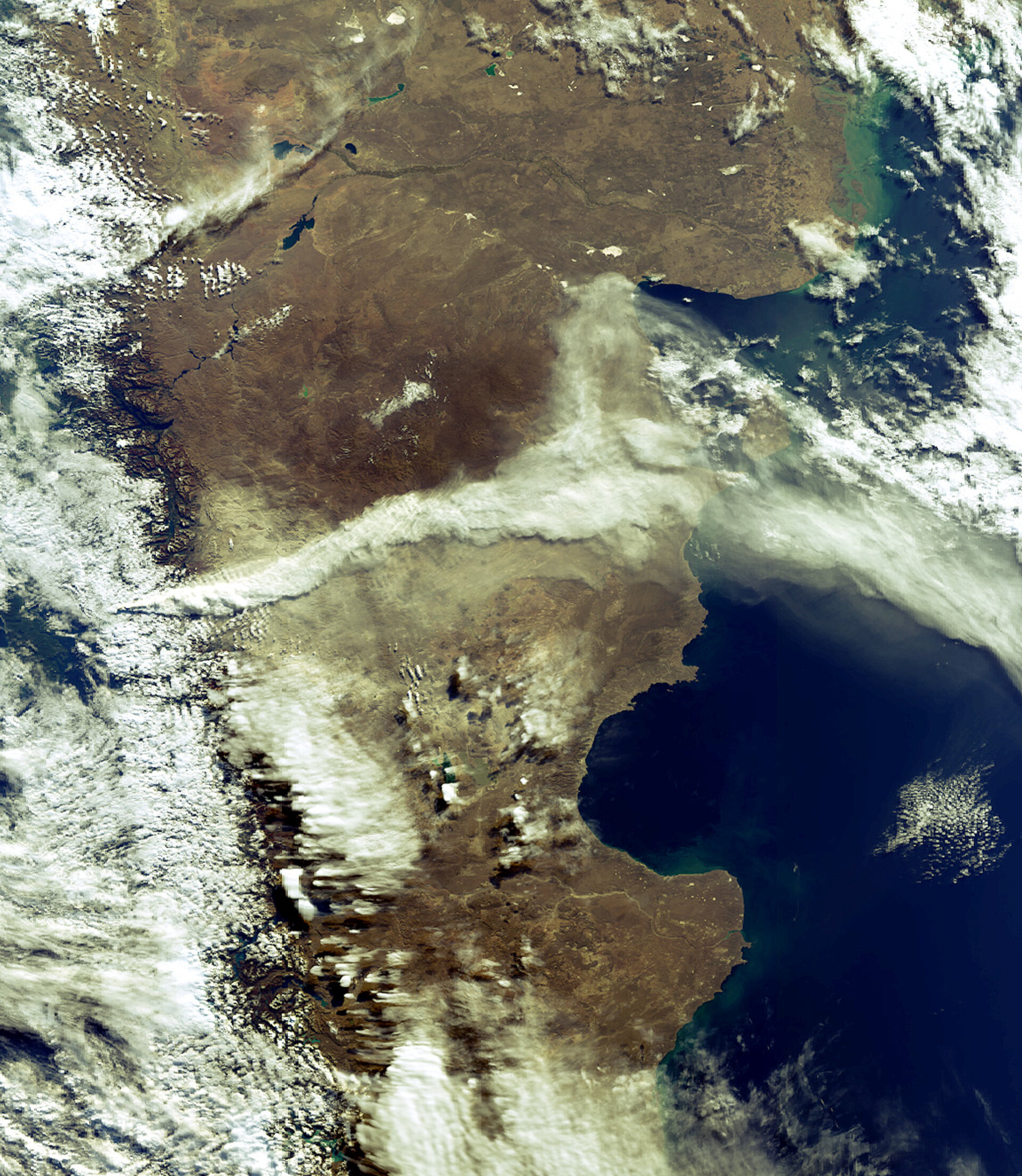
Chilean volcano captured blasting ash
Chile’s Chaiten Volcano is shown spewing ash and smoke (centre left of image) into the air for hundreds of km over Argentina’s Patagonia Plateau in this Envisat image acquired on 5 May 2008.
The 1000 m-high volcano had been dormant for thousands of years before erupting on 2 May, causing the evacuation of thousands. Chaiten Volcano is located in southern Chile 10 km northeast of the town of Chaiten on the Gulf of Corcovado.
Envisat’s Medium Resolution Imaging Spectrometer (MERIS) instrument processed this image at a resolution of 1200 m.
Satellite data can be used to detect the slight signs of change that may foretell an eruption. Once an eruption begins, optical and radar instruments can capture the lava flows, mudslides, ground fissures and earthquakes.
Atmospheric sensors onboard satellites can also identify the gases and aerosols released by the eruption, as well as quantify their wider environmental impact.
To boost the use of Earth Observation (EO) data at volcanic observatories, ESA has started to monitor volcanoes worldwide within the Agency’s Data User Element programme.
The Globvolcano project, started in early 2007, will define, implement and validate information services to support volcanological observatories in their daily work by integration of EO data, with emphasis on observation and early warning.