Choose your beach with Medspiration
Before you pack your swimsuit and head to the sea this summer, you may want to check out the water’s temperature with ESA’s Medspiration heat map of all
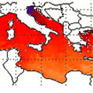
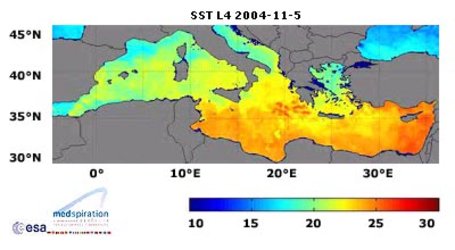
An updated map of the sea surface temperature (SST) of the world's largest inland sea is generated every day as part of ESA's Medspiration project, with an unprecedented spatial resolution of two square kilometres, high enough to detect detailed features like eddies, fronts and plumes within the surface temperature distribution.
In addition to ensuring you plunge into warm water, knowledge of SST is important for weather forecasting and is increasingly seen as a key indicator of climate change. The idea behind Medspiration is to combine data from multiple satellite systems to produce a robust set of sea surface data for assimilation into ocean forecasting models of the waters around Europe and also the whole of the Atlantic Ocean.
Like thermometers in the sky, a number of different satellites measure SST on an ongoing basis using state-of-the-art instruments. Medspiration utilises data from ESA’s Envisat and Meteosat-8, the United States’ National Oceanic and Atmospheric Administration (NOAA) polar orbiters, the Japanese’s Space Agency-NASA Tropical Rainfall Measuring Mission and the AMSRE instrument onboard NASA's Aqua.
The temperature of the surface of the ocean is an important physical property that strongly influences the transfer of heat and sensible and latent fluxes between the ocean and the atmosphere.
And because water takes a long time to warm up or cool down the sea surface functions as an enormous reservoir of heat: the top two metres of ocean alone store all the equivalent energy contained in the atmosphere.

Overall results from the Medspiration project also feed into an even more ambitious scheme to combine all available SST data into a worldwide high-resolution product, known as the Global Ocean Data Assimilation Experiment (GODAE) High-Resolution Sea Surface Temperature Pilot Project (GHRSST-PP).
ESA not only initiated Medspiration as the European contribution to the overall GHRSST-PP effort, but the also funded a GHRSST International Project Office, located at the Hadley Centre for Climate Prediction and Research, a part of the UK Met Office located in Exeter.
Under ESA contract, the Medspiration operations are carried out by the EUMETSAT Sea and Ice SAF at the Meteo-France's Centre for Space Meteorology and the French Research Institute for Exploitation of the Sea (IFREMER) under the leadership of the Southampton Oceanography Centre.