Satellites monitoring dust storms linked to health risk
Medical researchers are using satellites to track massive dust storms blowing across Africa's Sahel belt. The aim is to learn more about lethal meningitis epidemics that often follow in the dust's wake.
"Meningitis outbreaks take place after a period without rain, low humidity and lots of dust in the air," explained Isabelle Jeanne of the Niger-based Centre de Recherche Médicale et Sanitaire (CERMES), associated with the international network des Instituts Pasteur and a partner in ESA's Epidemio project.
"The exact correlation is not yet known. But making use of satellite data enables us to follow week by week the development of the dust storms and the appearance of conditions favourable for an epidemic to start."
Meningitis is an inflammation of the brain and spinal cord lining known to cause seizures and deafness in those victims it does not kill outright. Meningococcal meningitis – caused by the meningococcus bacteria – is the only form of the disease to spread in epidemic form. Outbreaks occur throughout the world but are most common in the 'meningitis belt' of semi-arid sub-Saharan territory known as the Sahel.
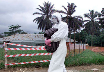
Meningitis mainly attacks children and young adults. The 18 nations of the Sahel have under-resourced healthcare systems: without treatment 70% of cases will perish, though with prompt anti-biotic therapy the death rate is reduced to one in ten.
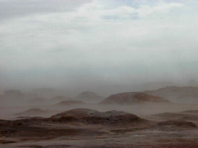
Researchers want to study the hypothesis that the Sahel dry season – when wind-blown dust of talcum-powder-consistency can fill the arid air – makes the 300 million inhabitants of this region much more vulnerable to meningitis infection.
The source of infection is other people: up to a quarter of the people may be carrying the source of the meningocuccus bacteria without symptoms, spreading the infection through overcrowded living conditions by droplets from coughing or throat secretions. Normally meningococcus dwells harmlessly in the nose and throat – it is only when it gets into the bloodstream it becomes a potential killer.

"The dryness and dust does not spread the bacteria directly," Jeanne explained. "Instead it seems as though the irritation caused to local inhabitants' mucus membranes renders them more vulnerable to bacterial infection. However an epidemic begins to decrease as soon as the first rain comes."
Therapeutic vaccination is a possibility, and drugs are available to lower morbidity levels. With supplies limited, it would be helpful to be able to anticipate the likeliest times and places of fresh outbreaks.
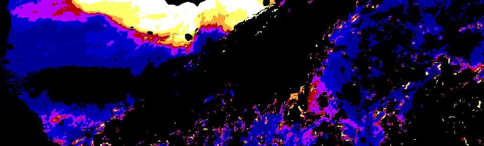
For this reason, during the last dry season, ESA has been supplying weekly dust maps of the Sahel as part of an early warning system. The maps are based on daily images from the Meteosat Visible and InfraRed Imager (MVIRI) aboard the ESA-built Meteosat-7 geostationary weather satellite.
"The dust maps have been very useful so far," Jeanne added. "There have been no meningitis outbreaks this year - fortunately for the inhabitants - so we cannot show a correlation as yet. The next planned step is to obtain archived images for the last ten years, to search for correlations against our records."
This activity is part of a wide-ranging ESA Data User Element project called Epidemio, developing Earth Observation (EO) services for epidemiologists.
Led for ESA by the company Jena-Optronik GmbH, with partners including the World Health Organisation (WHO), Epidemio is based on the principle that more detailed information on the environments within which infectious diseases occur can help epidemiologists study, understand and predict threats to human health.