
Interoperability
Although all Satellite-Based Augmentation Systems (SBAS) are regional systems, it is important to ensure that they are compatible and that SBAS providers cooperate with each other and coordinate their actions.
Compatibility will make each system more effective and ensure that all the systems can be integrated into a seamless worldwide navigation system.
SBAS cooperation is currently coordinated through the Interoperability Working Groups EGNOS/MSAS and EGNOS/WAAS. Interoperability tests are regularly organised.
At present, SBAS are being, or have been, developed to cover the following areas:
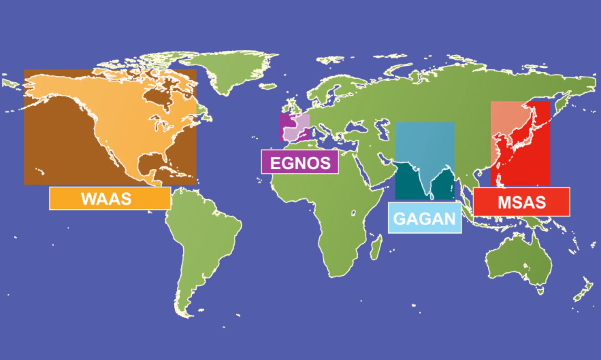
Europe
The European Tripartite Group, composed of ESA, the European Union and Eurocontrol, has developed EGNOS, the European Geostationary Navigation Overlay Service. EGNOS covers the European Civil Aviation Conference (ECAC) region.
United States
The United States Federal Aviation Administration leads the development of the Wide Area Augmentation System (WAAS). This covers the United States and Canada.
Japan
The Japanese Civil Aviation Bureau is implementing the MTSAT Satellite-Based Augmentation System (MSAS), which will cover the Flight Instrument Rules region of Japan.
India
The Indian Space Research Organization (ISRO) along with the Airport Authority of India (AAI) has worked on a joint programme to implement GAGAN, a Satellite Based Augmentation System using GPS/GLONASS over Indian airspace.
