Satellite’s final images focus on changing glaciers
Some of the last images from ESA’s ERS-2 satellite have revealed rapidly changing glacial features in Greenland. In its final days, the veteran satellite gave us frequent views of the Kangerdlugssuaq glacier and its advancing ice stream.
Before it retired on 6 July, ESA’s ERS-2 Earth observation satellite entered an orbit to capture radar images of the same area on the ground every three days, rather than its previous 35-day cycle.
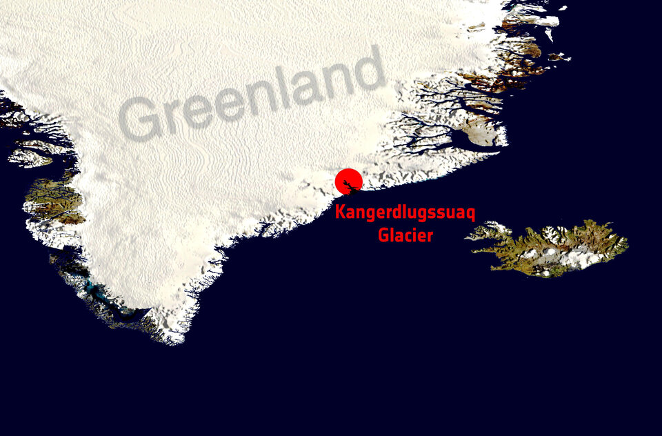
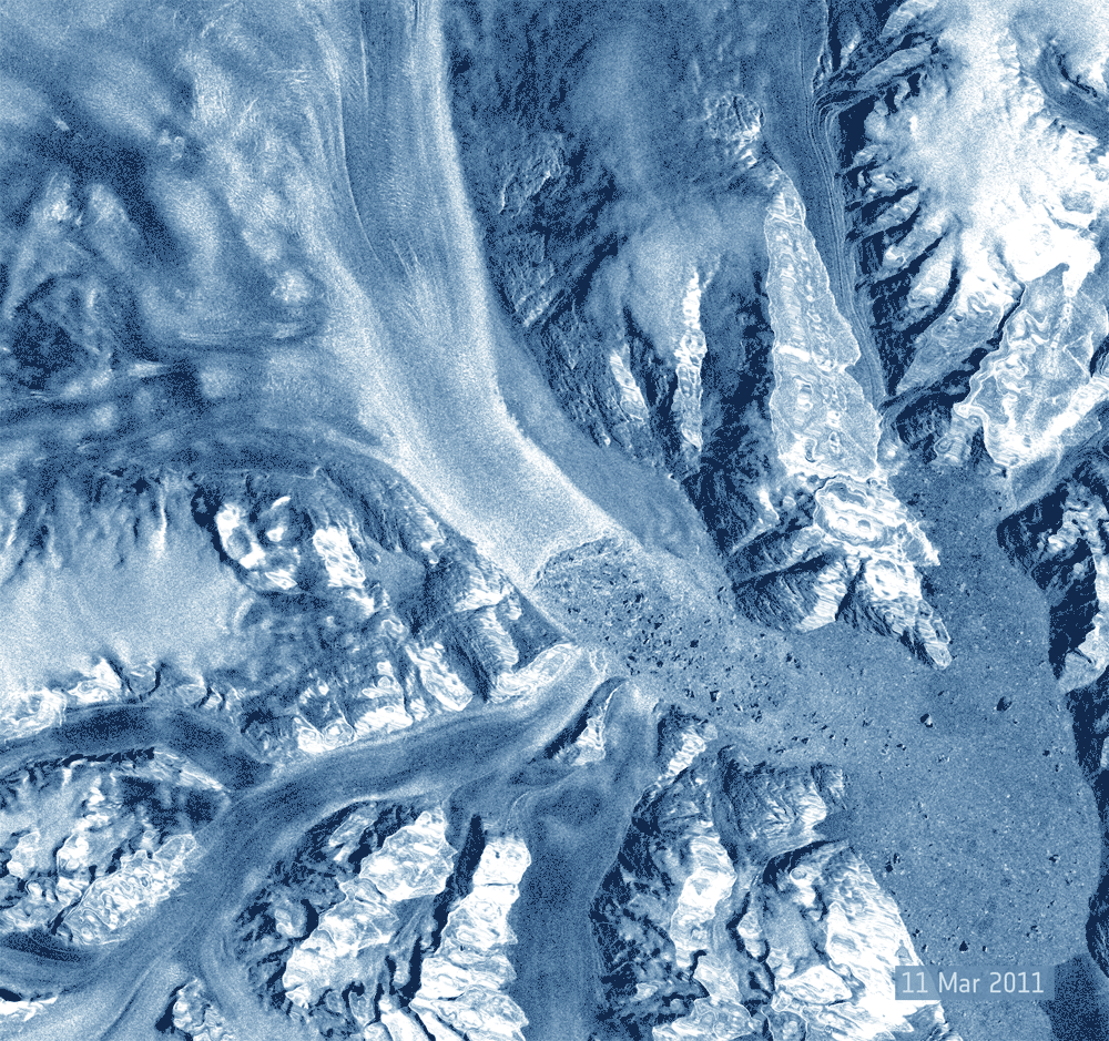
Images of the Kangerdlugssuaq glacier in eastern Greenland taken from March to May 2011 show that the ice stream was advancing steadily at about 35 m per day.
Then, between 19 and 22 May, a 9 sq km piece of the glacier broke up into icebergs.
Information from this ERS-2 ‘Ice Phase’ is helpful for studying rapid changes such as landslides, tectonics movements, sea ice and growing crops.

Compared to images of Kangerdlugssuaq taken by sister-satellite ERS-1 in 1992, the latest images show that the ice stream’s calving front has retreated by five kilometres in the past 19 years. The simultaneous thinning of the ice is also evident in the upper part of the stream.
“The data have revealed continued acceleration and retreat of glaciers in both Antarctica and Greenland, and are certain to become one of the most important records of climate change during the satellite era,” says Professor Andrew Shepherd of the University of Leeds in the UK.
The ERS-2 European Remote Sensing Satellite was launched in April 1995 and has spent more than 16 years in space – far longer than its design life of three years.
The main instrument is a synthetic aperture radar (SAR), which images Earth in practically all weather and lighting conditions.
ERS-2 also provided measurements of ozone, sea-level heights and surface temperatures.
"Now that ERS-2 is retired, no other flying or planned satellite is able to accurately detect the grounding line location of ice streams,” says Marcus Engdahl, scientific coordinator of the ERS-2 Ice Phase.
“This will make the data gathered by ERS-2 during its final months all the more valuable for scientists.”
ERS-2 and the Petermann glacier
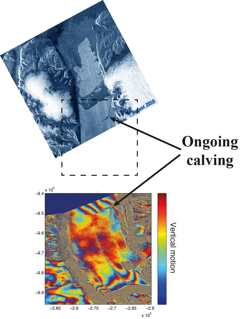
In August 2010, a 245 sq km iceberg detached from the Petermann glacier in northwest Greenland in a rare event detected by ESA’s Envisat satellite.
Through the use of ‘InSAR’ processing – a technique that can detect movements of only centimetres – the new ERS-2 images reveal that the calving event at Petermann might not yet be over.
Dr Noel Gourmelen, a research fellow in ESA’s Support To Science Element programme, explains that ERS-2 has revealed “that the tip of the Petermann glacier is moving widely with the ocean tides, while the remaining glacier shows more steady movement, revealing that the current tip of the glacier – an area half the size of the previous calving – is already partly detached.”