Taking apart a hurricane: multi-sensor Envisat sees through Frances
Hurricanes are one of those forces of nature that can only fully be captured by satellite imagery. For Hurricane Frances, currently thundering towards the United States coast, ESA's Envisat is going one better, peering through the hurricane from top to bottom, even helping to 'see' under the waves to map hidden forces powering the storm.
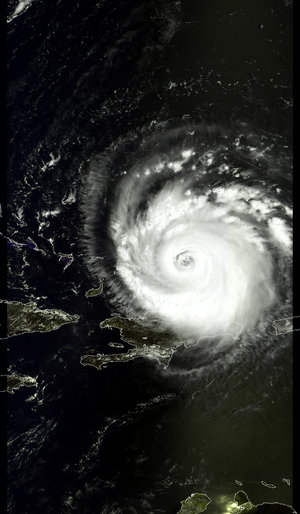
As its 235-km-per-hour winds passed the Bahamas, Frances was heading for landfall on the Florida coast some time on Saturday, and three quarters of a million Americans are in the process of evacuating their homes. To wait and watch for Frances might be suicidal for human beings, but space-based observers such as Envisat observe its passage without danger.
"Because of Envisat's multi-sensor capability, we can slice right through the hurricane with just a single satellite," explained José Achache, ESA Director of Earth Observation Programmes.
"Effectively Frances is taken apart for meteorologists to study. The data returned by Envisat includes cloud structure and height at the top of the hurricane, wind and wave fields at the bottom, sea surface temperature and even sea height anomalies indicative of upper ocean thermal conditions that influence its intensity."
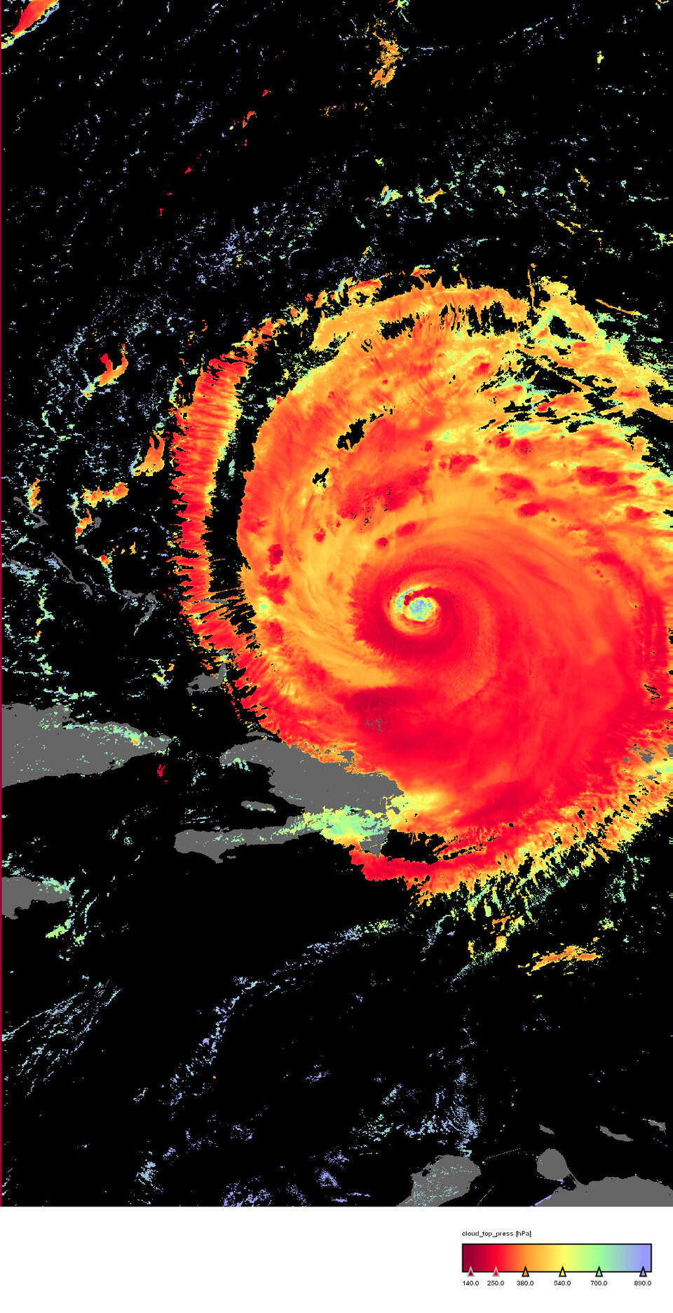
Important processes occur at a range of altitudes and locations throughout a hurricane - basically a large powerful storm centred around a zone of extreme low pressure.
Strong low-level surface winds and bands of intense precipitation combine with strong updrafts and outflows of moist air at higher altitudes, with energy released as rainy thunderstorms. Until now, the only reliable source of such high-resolution measurements at different altitudes was from aircraft flown directly through the hurricane.
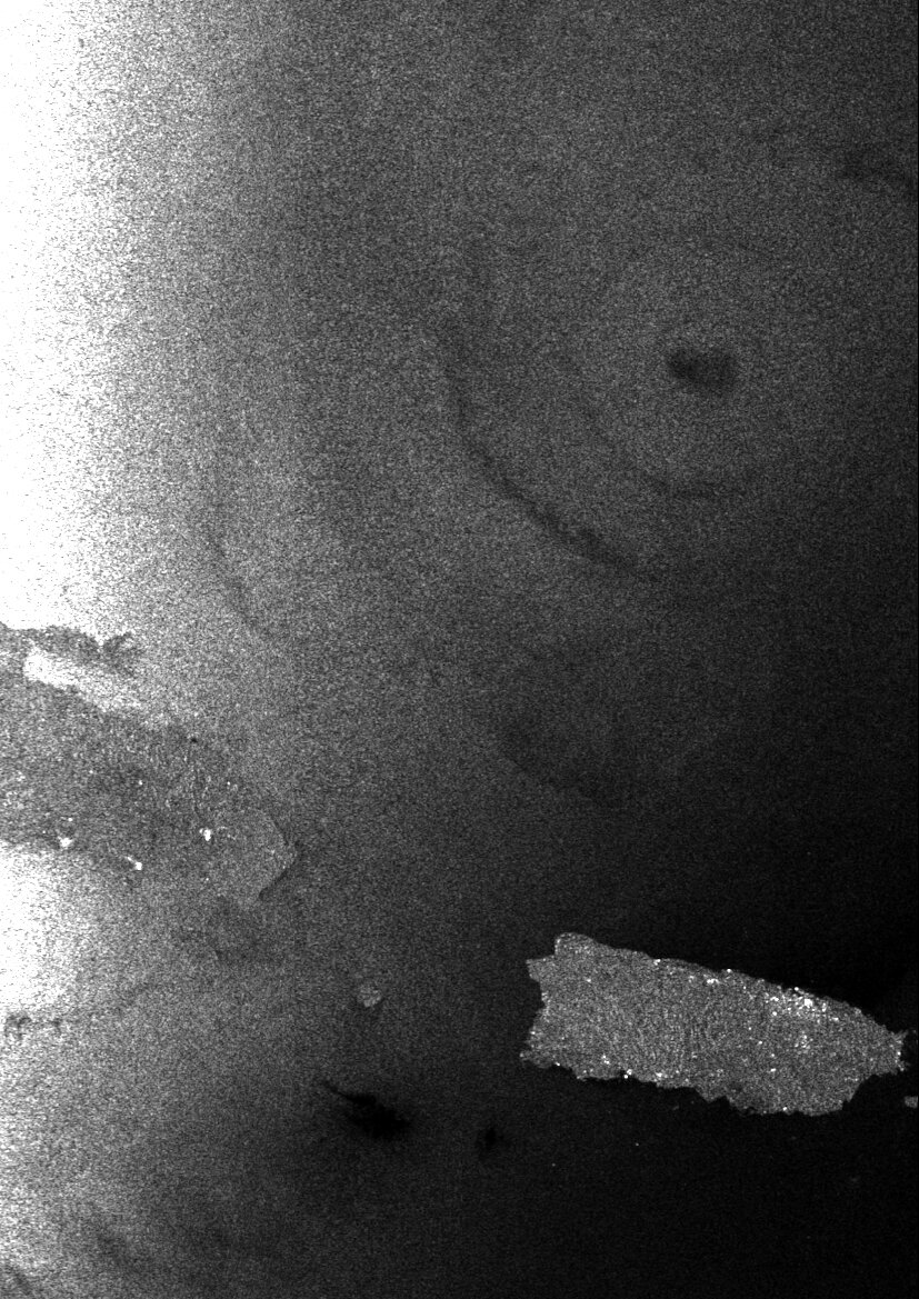
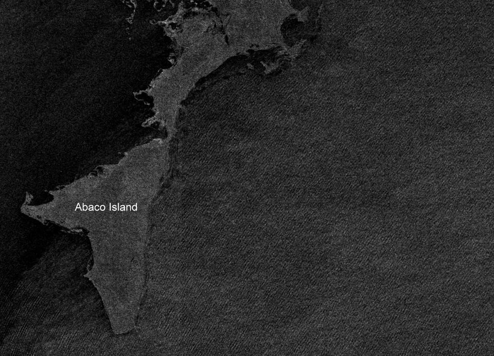
Envisat carries both optical and radar instruments, enabling researchers to observe high-atmosphere cloud structure and pressure in the visible and infrared spectrum, while at around the same time using radar backscatter to measure roughness of the sea surface and so derive the wind fields just over it.
Those winds converging on the low-pressure eye of the storm are what ultimately determine the spiralling cloud patterns that are characteristic of a hurricane.
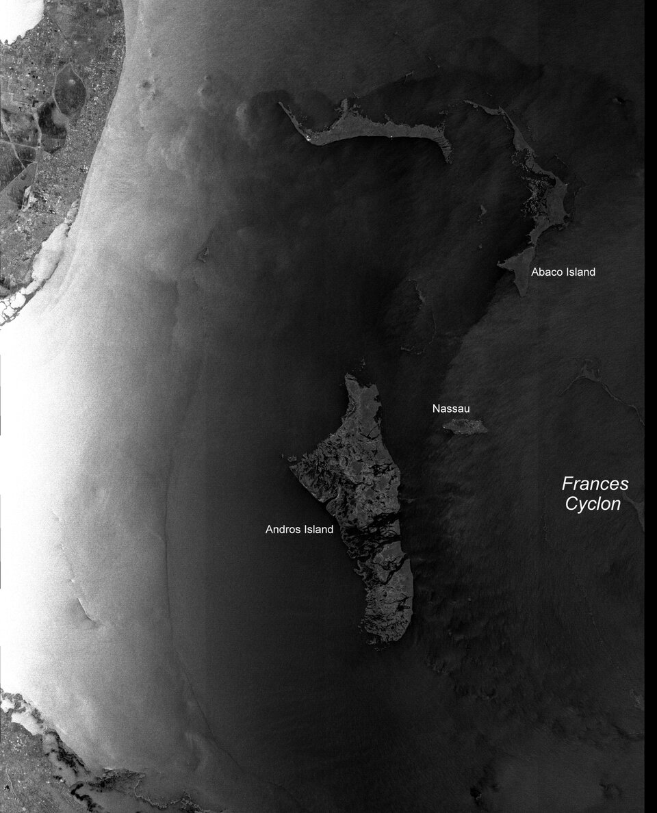
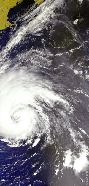
Florida-based scientists have begun to take advantage of this unique single-spacecraft combination of instruments – the Medium Resolution Imaging Spectrometer (MERIS) and Advanced Synthetic Aperture Radar (ASAR) – as hurricane season gets into full swing.
The University of Miami's Centre for Southeastern Tropical Advanced Remote Sensing (CSTARS) ground station has an agreement to acquire ASAR and MERIS data direct from Envisat, with ERS-2 wind scatterometer data set to follow in the near future. Their access to Envisat data has come just as the second hurricane in less than a month is heading towards the Florida coast.
"With MERIS and ASAR, Envisat can image both the ocean and atmosphere pretty much simultaneously, which is a very useful capability during hurricane season," said Hans Graber, Professor of Applied Marine Physics at the University of Miami and Co-Director of CSTARS.
While MERIS returns detail on the swirling clouds at the top of the hurricane, ASAR pierces right through the clouds to show the wind-wracked face of the sea beneath the storm.
"Specifically in terms of Frances, the eye of the hurricane seems to be rolling a lot right now from the top of the clouds, looking quite unstable, the information from an ASAR image should help localise its size and position on the ocean," Graber said. "And wind fields around the eye wall can be derived from ASAR data – right now all we have to go on are measurements from the hurricane hunter planes that fly right through the storm."
Simultaneous MERIS and ASAR acquisitions are planned for Friday by CSTARS, even as the storm comes closer to predicted landfall the following morning.
"Our current activity is along the lines of a shakedown – we're investigating how this can be used," added Graber. "Our final goal is to get this working on an operational basis during hurricane season. We have a deal to use radar data from the Canadian Space Agency, and also have access to other satellite resources for high temporal coverage of the affected region.
"The potential is there to extract a large amount of useful information which can help the US National Hurricane Center increase the accuracy of their hurricane predictions and reduce danger to the public."
Envisat's 'thermometer' takes Frances' temperature
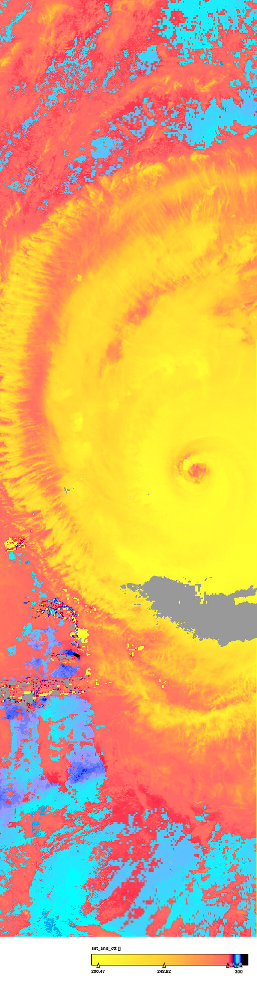
Another instrument aboard Envisat is being used to take the temperature of Frances, both down at the surface of the ocean and at the heights of its towering clouds.
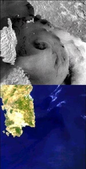
Water temperatures are the main underlying energy reservoir powering Frances; together with the correct atmospheric conditions, they need to exceed 26ºC in order to form and maintain a tropical cyclone. Envisat's Advanced Along Track Scanning Radiometer (AATSR) works like a space-based thermometer, acquiring the temperature of the sea surface down to a fraction of a degree.
Meanwhile AATSR also returns useful atmospheric data, measuring the temperature of the top of hurricane clouds – the higher into the atmosphere they extend, the colder they are - and also deriving their ice content.
"We produced a combined AATSR sea surface temperature and cloud top temperature image, which shows the sea surface temperature to be as high as 29ºC in the area," remarked Carsten Brockmann of Brockmann Consult, a German company processing both MERIS and AATSR hurricane imagery. "This two-sensor combination gives meteorologists a lot of information to help them understand the dynamics of the hurricane and better predict its development."
AATSR information can be correlated with MERIS data cloud height and development to gain a good estimate of the hurricane's precipitation potential, and improve understanding of how this relates to its overall intensity. Condensation of water vapour releases latent heat, which warms the vicinity of the hurricane eye. This in turn evaporates more surface water and feeds the heat engine powering the hurricane.
Studying hidden depths that fuel the storm
The thermal energy of warm water, which partly powers a hurricane, is known as tropical cyclone heat potential (TCHP).
Oceanic features, such as warm core rings, eddies, and the Gulf Stream, represent a source of enhanced heat fluxes to the atmosphere that may cause the strengthening of tropical cyclones, such as hurricanes.
Warm waters may extend to at least 100 meters beneath the surface in many of these oceanic features, representing waters of very high heat content. Several hurricanes have intensified when their tracks pass over eddies or other masses of warm water with high TCHP values.
For example, in 1995 Hurricane Opal suddenly intensified in the Gulf of Mexico after passing over a warm ring with TCHP values of up to six times the threshold to sustain a tropical cyclone.
Previously, researchers used sea surface temperature alone to estimate the role of the upper ocean thermal conditions on hurricane intensification. The problem with this is that the sea surface temperature measured by AATSR or comparable satellite instruments may not by themselves show these warm upper ocean features, particularly during summer months in tropical regions.

In the past these upper ocean features have gone unseen by satellite-based temperature sensors because they are effectively camouflaged beneath a very shallow and stable layer of warmer water.
Tropical cyclone wind forces easily erode this thin upper layer by mixing the upper waters to depths that may go down to 100 meters, giving the tropical cyclones the potential to absorb ocean thermal energy, if conditions are appropriate. Now, estimates of TCHP based on satellite observations of sea surface temperature and sea surface height can detect these features.
Researcher Gustavo Goni, Joaquin Trinanes and Peter Black of the US National Oceanic and Atmospheric Administration's Atlantic Oceanographic and Meteorological Laboratory (NOAA/AOML) are working on this original methodology to detect these warm water masses and to compute their tropical cyclone heat potential values using several satellite sensors including one on Envisat.
"These water features are critical for identifying regions of high TCHP values that may potentially contribute to the intensification of a hurricane”, Goni explained. "These regions of high TCHP values provide the hurricanes with the opportunity to absorb much more thermal energy if overall conditions are right. My research is taking advantage of the fact that these warm water masses cause an upward elevation in ocean height of up to 30 cm. Such sea height anomalies can then be mapped with space-based radar altimeter data."

Radar altimeters, such as the Radar Altimeter-2 instrument on Envisat, fire hundreds of radar pulses down to Earth every second, and by timing their return down the nanosecond can measure sea height to a maximum accuracy of two centimetres from hundreds of kilometres above the Earth.
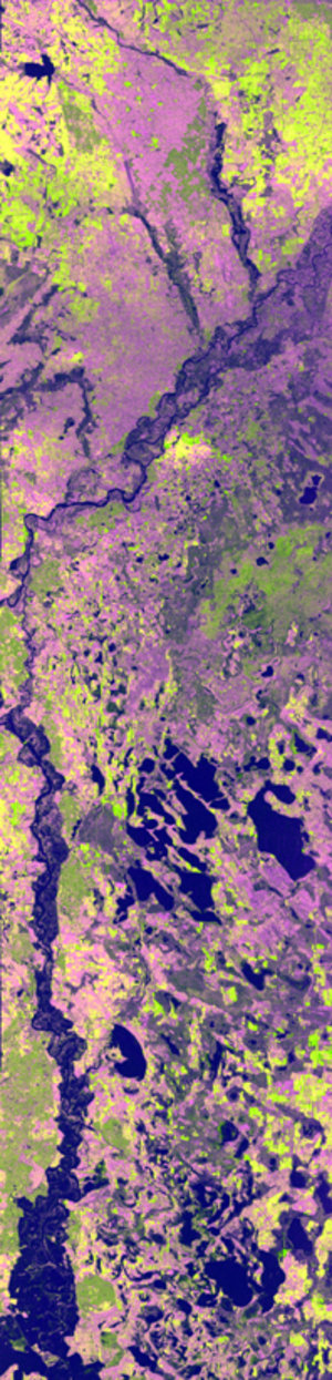
The US Naval Research Laboratory (NRL) combines Envisat RA-2 data with data from similar radar altimeters aboard the Jason-1 and GFO satellites to enhance overall accuracy and spatial and temporal coverage, forming the source for altimetry products which, in turn, form the basis for NOAA/AOML-produced maps of tropical cyclone heat potential depicting the upper ocean thermal conditions, shown here overlaid against Hurricane Frances' track so far.
" At this time I use this product only for research purposes, providing an enhanced understanding of the life of a hurricane. However, analogous products are being produced and used operationally for forecasting by the National Hurricane Center", Goni concluded.
Altimetry-based wind speed and wave height products are also distributed by the French firm Collecte Localisation Satellites (CLS), and can reveal sea surface features related to the presence of hurricanes.
Envisat results to be revealed

Launched in March 2002, ESA's Envisat satellite is an extremely powerful means of monitoring the state of our world and the impact of human activities upon it. Envisat carries ten sophisticated instruments to observe and monitor the Earth's atmosphere, land, oceans and ice caps, maintaining continuity with the Agency's ERS missions started in 1991.
After two and a half years in orbit, more than 700 scientists from 50 countries are about to meet at a special symposium in Salzburg in Austria to review and discuss early results from the satellites, and present their own research activities based on Envisat data.
Starting on Monday, the Envisat Symposium will address almost all fields of Earth science, including atmospheric chemistry, coastal studies, radar and interferometry, winds and waves, vegetation and agriculture, landslides, natural risks, air pollution, ocean colour, oil spills and ice.
There are over 650 papers being presented at the Symposium, selected by peer review. Presentations will include results on the Prestige oil spill, last year's forest fires in Portugal, the Elbe flooding in 2002, the evolution of the Antarctic ozone hole, the Bam earthquake and pollution in Europe.
Numerous demonstrations are planned during the week in the ESA Exhibit area. An industrial consortium exhibit on the joint ESA-European Commission Global Monitoring for Environment and Security (GMES) initiative is also planned.