
Mediterranean hot flush detected after scorching summer
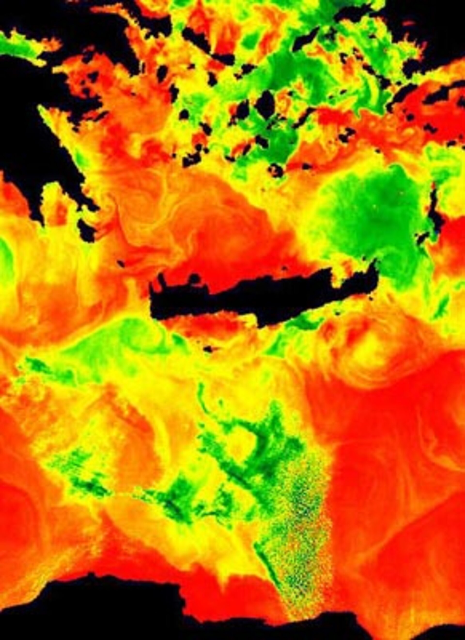
Our record-breaking long hot summer heated Europe's seas as well as the land. Results returned from ESA's Envisat environmental satellite show Mediterranean waters off Crete around three degrees Celsius warmer than the previous year.
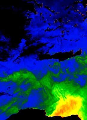
The top image represents sea surface temperature around the island for 31 August 2003, while the second image shows it for 30 August 2002. The brighter the colour the higher the temperature: there is a five-degree difference between the two recorded in waters north of Crete, and a two-to-three degree difference south of Crete. The maximum (bright red) temperature shown in the two images is 25 degrees, the minimum (dark blue) is 16 degrees. Areas in black are either land or covered by cloud.
The data come from Envisat's Advanced Along Track Scanning Radiometer (AATSR), which functions like a space-based thermometer. The instrument records infrared wavelengths of light to calculate sea surface temperature to an accuracy of 0.3 degrees and a spatial resolution of 1 sq km. The images were prepared for ESA by the Rutherford Appleton Laboratory.
"The difference between the two years is a striking demonstration of how variable the climate can be," said Professor David Llewellyn-Jones of University of Leicester, the Principal Investigator for AATSR. "Sea surface temperature is an especially important factor in climate studies because it takes a long time and the transfer of a lot of heat to change it.
"The oceans actually represent an enormous reservoir of heat. It's not generally realised but they absorb directly the majority of energy radiated from the Sun due to their surface area – covering about 71 per cent of the Earth's surface. The oceans then transfer heat directly to the atmosphere."
The oceans are a good indicator of possible climate change because they actually store a huge amount of solar heat, and their temperatures are an indication of how much heat they hold. They take much longer to warm up or cool down by comparison to the land or the air, so sea surface temperature records can be used to help identify longer-term climatic trends.
"By themselves, these particular AATSR images just show us is that the climate varies – and that's nothing new, climate is always fluctuating," said Llewellyn-Jones. "And these are images of two different days in a single locality. Where the AATSR data really become useful are on a larger scale, and over a long time scale."

Earlier versions of the AATSR flew aboard ESA's previous
"Studying climate models show us we need at least 15 years worth of data to differentiate a definite global temperature increase from the normal variability of climate," explained Llewellyn-Jones. "Preliminary analysis of existing results does indicate a general upward trend, but we will be more certain with more time and more data."
The UK's Department for Environment, Food and Rural Affairs (DEFRA) and National Environment Research Council (NERC) developed AATSR along with an additional funding contribution from Australia. The instrument can also be used to measure cloud characteristics, land surface cover, plant health and even see forest blazes as they burn. It is one of ten instruments aboard ESA's Envisat environmental satellite, orbiting the Earth every 100 minutes from 800 km up.
