

TUBE-ing with TESEO: Treaty officials assess how space could help
One international treaty official offered to a recent ESA workshop his motivation to participate in a pilot project to see how satellite imagery could monitor international treaties.
There is a perception that the world is losing its quality wetlands through ecological deterioration," said Nick Davidson, Deputy Secretary General for the Ramsar Convention, a treaty on wetlands conservation. "In practice, we have little idea of what is really going on."
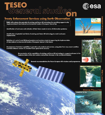
The practice and potential of using ESA satellite imagery in treaty applications was the focus of the third TESEO Users Brainstorming Event (TUBE 3), held 23 January at ESA’s ESRIN facility in Frascati, Italy. ESA established TESEO, for Treaty Enforcement Services using Earth Observation, two years ago to open a dialogue with the secretariats and others involved in this international community to see if, and how, satellite imagery could be of help.
The international conventions either involved in the TESEO effort, or exploring the opportunity to work more closely with ESA in using Earth observation data, cover a wide range of activities, from monitoring wetlands and ensuring compliance with Kyoto Protocol emission targets to combating desertification and preserving World Heritage sites and protecting gorillas in east and central Africa. For ESA, TESEO represents a means to establish a dialogue and determine the requirements of these important players on the global scene for practical, useful EO products.
TESEO pilot projects

In the TESEO project, ESA assisted the Ramsar Convention to see "what’s really going on" by funding a demonstration project to use radar imagery in creating maps and studying the changes in test wetlands areas in Canada, Spain and Senegal. A team of remote sensing companies headed by Canada’s Atlantis Scientific worked ecological authorities and research institutes in the countries in seeing what Earth observation products could be developed and applied to local user requirements.
For wetlands applications, reported Don Ball, project manager with Atlantis, satellite data won’t provide all the answers. "Data must be integrated from several sources," he observed. "Including Earth observation, other geospatial sources, ground observations, chemical and biological information."
As a follow-on to the pilot project for the Ramsar Convention, ESA will fund the €1 million Globwetland program to produce wetlands inventory maps and digital elevation models covering both wetlands and surrounding catchment areas. Users in the project, according to Olivier Arino, head of the Projects Section within ESA’s Earth Observation Programmes, will include the Convention’s national points of contact, wetlands managers, non-governmental agencies and scientific researchers engaged in local wetlands studies.
The service definition phase of the program will start next year, Arino said, with the formulation and assessment of potential EO products for the effort scheduled to run through 2005.
Forest inventories for Kyoto

Another project arising from the TESEO initiative is the Kyoto Inventory, a €1 million commitment to produce forest inventory and change maps for users including the Finnish Forest Research Institute, the Italian Ministry of Environment, the Norwegian Ministry of Agriculture, and the Swiss Agency for the Environment.
The project will be undertaken to support the United Nations Framework Convention on Climate Change (UNFCCC), adopted in 1992 and which, in turn, led to the adoption five years later of the Kyoto Protocol that broke new ground with its legally binding restraints on signatories concerning greenhouse gas emissions.
The UNFCCC secretariat has participated in TESEO for the past two years to determine whether satellite imagery could be beneficial to signatories in developing their Kyoto-mandated national greenhouse inventories,” including details on their forest areas, along with other crop and agricultural areas, that act as natural "sponges" in soaking up carbon dioxide, the most important greenhouse gas.
Providing this annual report on national greenhouse inventories requires accurate data on national and regional scales concerning changes in land uses and forest areas, according to Claudio Forner, an official with the Convention’s methods, inventories and science programme.
Unfortunately, he added, it’s not an easy requirement to meet. Of the 41 leading industrialised nations that comprise the so-called "Annex I" categories of Kyoto countries, only 27 provided their annual greenhouse gas inventories in 2001, Forner said.
"Measuring carbon and identifying land-use change on an annual basis is a very difficult task," he added. "It’s simply too costly."
A lack of information on a supra-national scale, as well as differences in how land use and forest inventories are calculated also compound the difficulties in providing a common national inventory of land use and how it changes. For instance, only half of Italy’s regions have prepared estimates on their forest inventories. Of those completed, said Lucia Perugina from the University of Tuscia, sharp differences were evident in the datasets and measurements. "It makes consistency difficult," she said.
For Forner, addressing these shortcomings in national and regional reporting makes the use of satellite data attractive. The benefits to EO data from space include lower costs, and the prospects of a consistent and effective standard of reporting the data, the UN official said.
Despite his optimism, widespread use of satellite observation to assist in the development, or verify the accuracy, of national greenhouse inventories will raise some ticklish political questions concerning the external monitoring of a country’s sovereign resources from space.
"The use of satellite data (for monitoring compliance) has not been considered by my Convention," he said. "We still have a long way to go."
Fighting desertification with better information

While the spread of desertification and the effects of drought have clear global implications, from contributing to 50 armed conflicts in 1994 to creating potentially 50 million environmental refugees by 2010, Rui Zheng, Programme Officer with the UN Convention to Combat Desertification (UNCCD), told the workshop.
National and international efforts to combat desertification have been hampered by the lack of reliable desert inventories and the capacity in developing countries to utilise fully the analytical tools offered by remote sensing technologies, he added. To help address these shortcomings, Zheng outlined one of UNCCD’s initiatives to assist countries monitor and assess desertification and drought, "so as to provide reliable information to the governments and people, as well as the international community, for wise solutions."
Pointing to the China in particular, Zheng noted that two desertification inventories have been conducted in the past ten years to identify the dynamic changes of land and ground vegetation, with a third one currently underway. Earth observation officials from ESA, together with representatives from UNCCD, the Chinese Academy of Forestry and other national research organisations will meet in Beijing in May to discuss ways that ESA's satellite imagery and expertise could assist in producing desertification maps and other efforts to combat desertification.
TESEO as a catalyst
TESEO was intended as a catalyst, a way to bring together separate communities that ordinarily do not talk with each other. It established a two-year-long forum in which to define what information shortfalls exists, define the EO products needed to address them and establish some short-term study projects to validate their accuracy.
The effort succeeded at focusing what types of satellite data are needed and which forms of analysis are useful in addressing users' needs for the Conventions that participated in the process, including Ramsar, UNFCCC, and UNCCD. Secretariats from other Conventions, including the World Heritage Convention (WHC) and the UN Convention on Biological Diversity (UNCBD), sent representatives attended the TUBE 3 workshop after hearing about the program from their colleagues.
Some of the individual pilot projects developed under TESEO, including the wetlands and the Kyoto inventory, will continue as independent activities. ESA currently is assessing whether the TESEO effort will go forward, according to ESA’s Arino, with a possibility that the initiative will be folded into the upcoming Global Monitoring for Environment and Security (GMES) initiative sponsored by ESA and the European Commission.
One new project, the €1 TESEO-MATRIX initiative, will see how the Earth observation requirements from the five Conventions present at the workshop – UNFCCC, Ramsar, UNCCD and UNCBD, and WHC – could be pooled to take advantage of the synergies among the Conventions’ requirements and offer economies of scale for new EO products and services. For its part, ESA will assist in the development of common EO products for analysing land cover and changes, land use and changes, and digital elevation models.
Representatives from the Conventions are expected to meet soon to discuss further the MATRIX project and agree on common test sites suitable for all.
The clear message coming from participants at the TUBE 3 workshop was that the effort to explore how data from space could help monitor international agreements is just at the starting point.
"A couple of years ago three or four communities came together, talking different languages, and we were a bit baffled how this would all work," Ramsar’s Davidson said. "Now we realize we where talking the same thing and the challenge now is – where does it go from here?"

