• → European Space Agency

      • Space for Europe
      • Space News
      • Space in Images
      • Space in Videos
    • About Us

      • Welcome to ESA
      • DG’s blog
      • For Member State Delegations
      • Business with ESA
      • Law at ESA
      • ESA Exhibitions
      • ESA Publications
      • Careers at ESA
      • ESAshop
    • Our Activities

      • Space News
      • Observing the Earth
      • Human and Robotic Exploration
      • Space Transportation
      • Navigation
      • Space Science
      • Space Engineering & Technology
      • Operations
      • Telecommunications & Integrated Applications
      • Preparing for the Future
    • Careers at ESA

    • For Media

      • Media
      • ESA TV
      • Videos for professionals
      • Photos
    • For Educators

    • For Kids

    • ESA

    • Space in Images

    ESA > Space in Images > 2016 > 03 > First image from Sentinel-3A

    Free Search (23874 images)

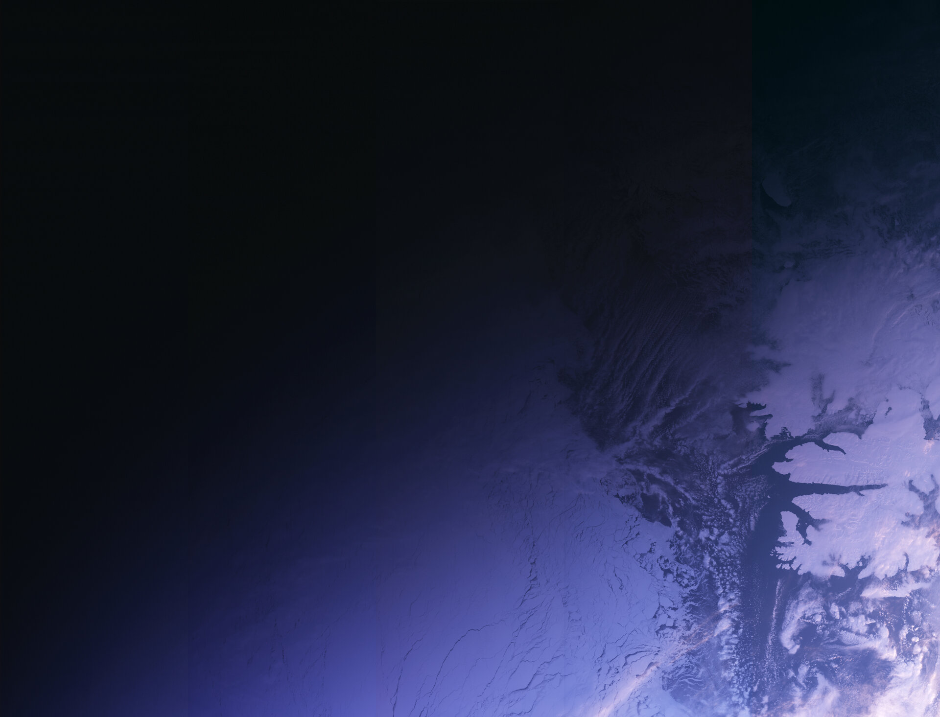
    First image from Sentinel-3A

    (5.03 MB)

    (55.80 MB)

    Details

    Open/Close
    • Title First image from Sentinel-3A
    • Released 02/03/2016 2:18 pm
    • Copyright Copernicus Sentinel data (2016)
    • Description

      Captured at 14:09 GMT on 29 February 2016 just two weeks after launch, the first image from the Copernicus Sentinel-3A satellite shows the transition from day to night over Svalbard, Norway. As well as showing the snow-covered archipelago, the image also details Arctic sea ice and some cloud features. The image was taken by the satellite’s Ocean and Land Colour Instrument, which features 21 distinct bands, a resolution of 300 m and a swath width of 1270 km. The instrument’s new eyes on Earth will allow ocean ecosystems to be monitored, support vegetation, crop conditions and inland water monitoring. It will also provide estimates of atmospheric aerosol and clouds, all of which bring significant benefits to society through more informed decision-making. Sentinel-3A’s instrument package also includes a Sea and Land Surface Temperature Radiometer, a Synthetic Aperture Radar Altimeter and a Microwave Radiometer.

    • Id 355616

    TAGS

    Open/Close
    • Click on the tags to find the matching images.
    • Activity Observing the Earth
    • Mission Sentinel-3

    TAGS

    Open/Close

    Details

    Open/Close

    Rate this

    Views

    Comments

    Share

    • Currently 4.5 out of 5 Stars.
    • 1
    • 2
    • 3
    • 4
    • 5

    Rating: 4.6/5 (71 votes cast)

    Thank you for rating!

    You have already rated this page, you can only rate it once!

    Your rating has been changed, thanks for rating!

    10118 1
    Tweet

    COMMENTS

    Open/Close

    COMMENTS

    Open/Close

    RELATED IMAGES

    • 02 March 2016 Strait of Gibraltar from Sentinel-3A 4195 Votes: 16
    • 08 March 2016 Europe viewed wide 3098 Votes: 27

    Related links

    • Copernicus

    • Sentinel-3

    USING OUR IMAGES

    Terms and conditions

    Contact us

    Commenting guidelines

    • Connect with us
    • Subscribe
    • mobile version
    • FAQ

    • Site Map

    • Contacts

    • Terms and conditions