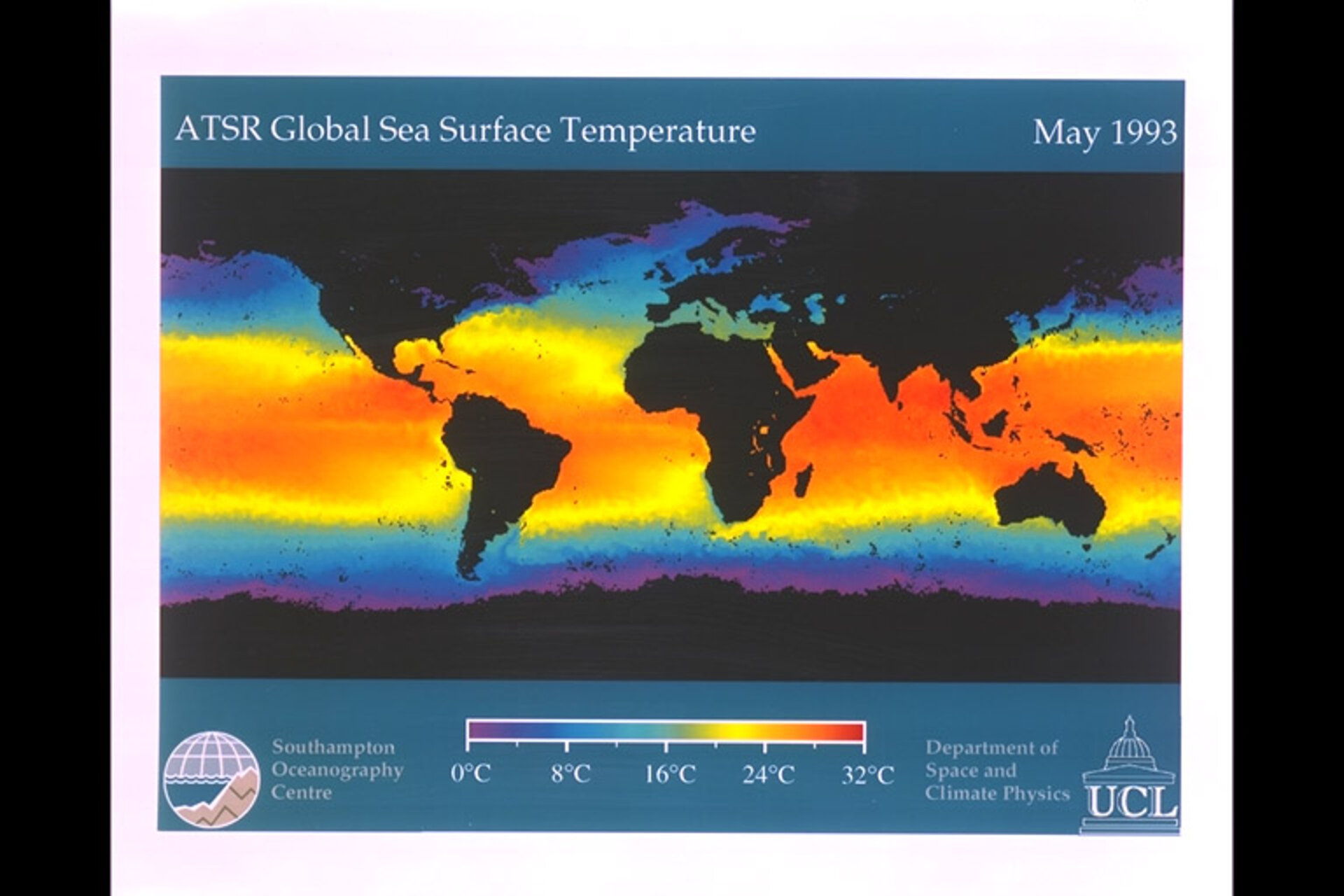
ERS-1/ATSR sea surface temperature
This figure shows the global sea-surface temperature measurements for May 1993 from the ATSR (Along-Track Scanning Radiometer)instrument on ERS-1. The data spatial resolution is 0.5deg and the measurements are accurate globally to better than 0.3degC. The few data gaps due to persistent cloud cover are shown as black. Clearly visible are the warm western boundary currents such as the California, Humboldt and Benguela currents, and the regions of cold upwelling off Namibia and Morocco. The effect of the Gulf Stream on Northern Europe is striking, the sea being warmer here than anywhere else at the same latitude. Also evident is the remarkable level of turbulent detail, particularly in the southern ocean. [Image Date: 03-05-96] [96.05.003-004]