Agency
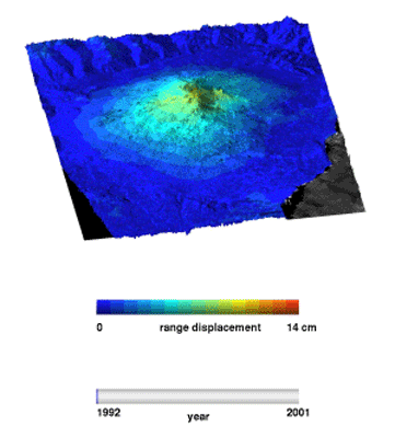
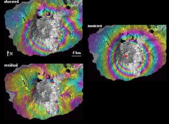
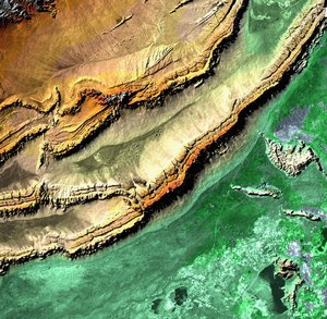
Radar interferometry to produce Digital Elevation Models
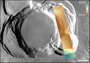
Radar interferometry to produce Digital Elevation Models - this one showing how a pair of images from twin ERS satellites were used to create one of the Etna volcano in Sicily, Italy. Pairs of images acquired from the same spacecraft during different orbits can also be used.