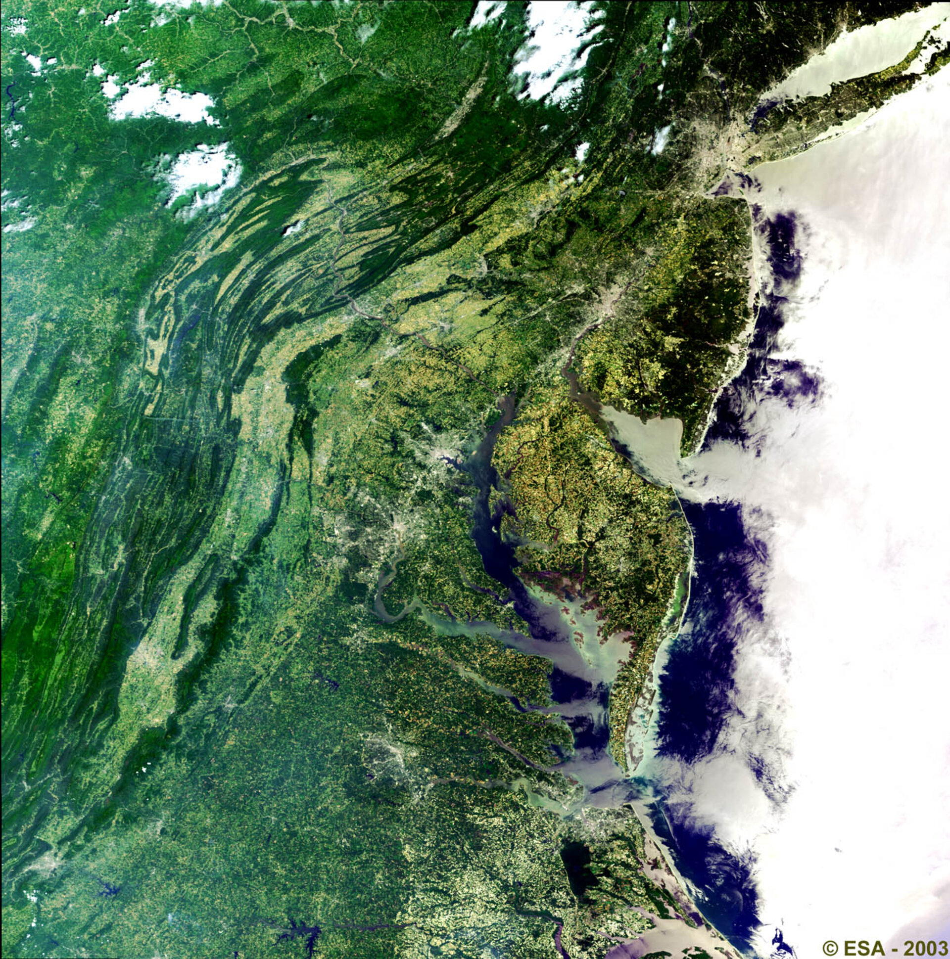
North East Coast, USA - MERIS, 25 June 2003
This Medium Resolution Imaging Spectrometer (MERIS) image is centred over the north east coast of the United States, from the state of New York (north) to the state of Virginia (south). Visible (shown in light grey areas) are starting from the top right are the cities of the New York Urban area, Philadelphia, Baltimore, Washington D.C. and Richmond. Centre left of the image are the Blue Ridge and Allegheny Mountain ranges. The dark blue patches along the coast are sedimentation transported down by the rivers. Bands 7 (red), 5 (green), and 2 (blue), corresponding to visible light, were used to create this image.
Technical Information:
Instrument: MEdium Resolution Imaging Spectrometer (MERIS)
Date of Acquisition: 25 June 2003
Orbit number: 06893
Instrument features: Full Resolution image (300 - metre resolution)
Coordinates:
NW Lat/Long: N 42.34 / W 78.55
NE Lat/Long: N 41.17 / W 72.07
SE Lat/Long: N 35.32 / W 74.13
SW Lat/Long: N 36.46 / W 80.30