Applications
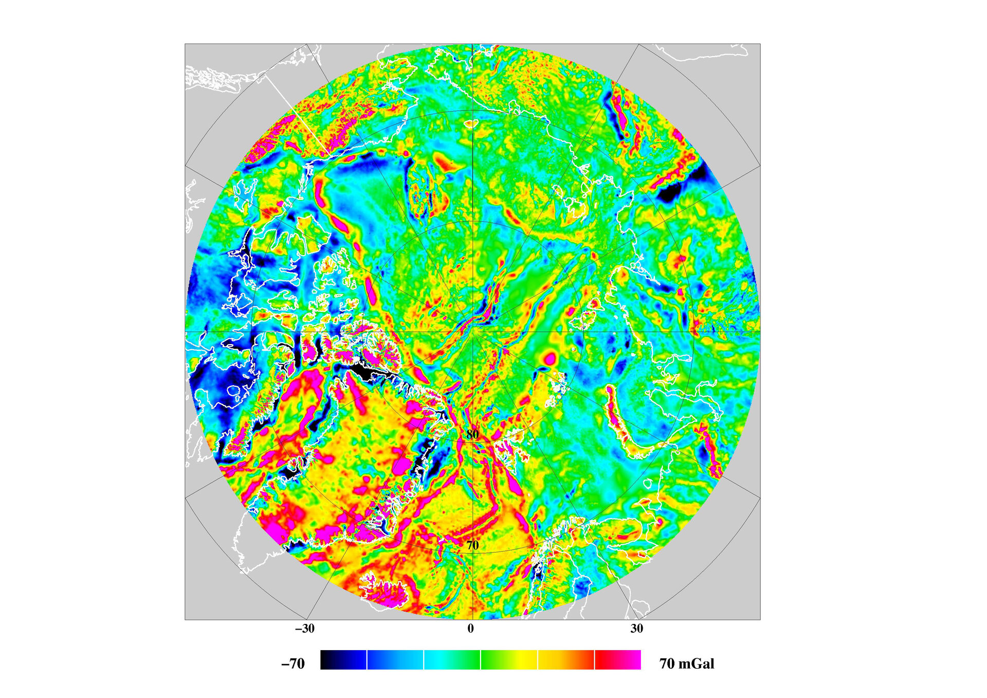
ArcGP grid, Jan 2006 (mGal)
ArcGP grid, January 2006 (mGal). Some ERS and ICESat altimetry has been used to fill in some data gaps/errors in the original compilation. (units mGal).
ArcGP grid, January 2006 (mGal). Some ERS and ICESat altimetry has been used to fill in some data gaps/errors in the original compilation. (units mGal).