Valles Marineris Digital Terrain Model (reduced resolution)
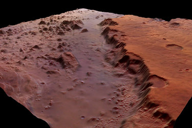
This image is a High Resolution Stereo Camera (HRSC) Digital Terrain Model (DTM) mosaic of Valles Marineris. It is shaded according to height. The Valles Marineris canyon was imaged by the High Resolution Stereo Camera (HRSC) instrument over 34 Mars Express orbits.
Around 46 Gigabytes of data were used to generate this DTM mosaic, which covers an area of approximately 1.3 million sq km. The DTM has a resolution of 200 m/pixel.
The resolution of the nadir image strips (obtained by pointing the camera vertically down to the surface) used in the mosaic is in the range of 11 to 70 m/pixel. Individual terrain models with a resolution of up to 50 m were derived for every HRSC image strip.
These high-resolution DTMs and ortho-images are derived through a complex process. Matching surface features were used to 'stitch' the images strips together, and complex geometrical calculations were used to produce the 3D coordinates of all measured points in the area.

Valles Marineris
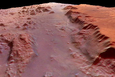
Close-up of the southern part of Valles Marineris
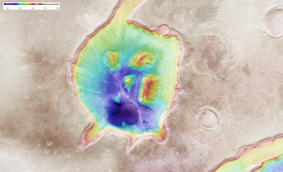
Mamers Valles colour-coded elevation model

Kasei Valles and Sacra Fossae ortho-image. North is…