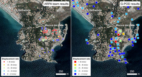
Applications
Sea ice displacement map
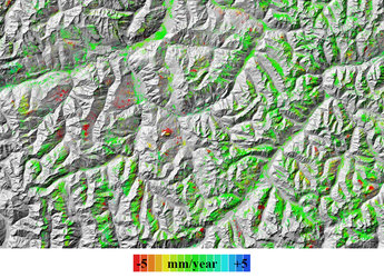
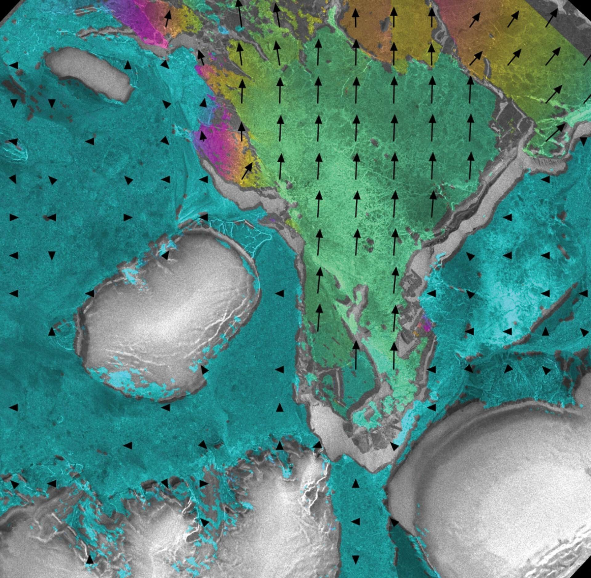
Geocoded sea ice displacement map. The green areas correspond to an observed displacement of about 160 m in 28 minutes. The image brightness corresponds to the backscattering of the Envisat image.
Geocoded sea ice displacement map. The green areas correspond to an observed displacement of about 160 m in 28 minutes. The image brightness corresponds to the backscattering of the Envisat image.