United space in Europe
Madagascar
Applications

Madagascar

03/07/2009 1284 views 3 likes 207010 ID
  • HI-RES JPEG [934.40 kB]
  • HI-RES TIFF [57.14 MB]

Thank you for liking

You have already liked this page, you can only like it once!

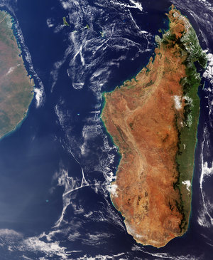
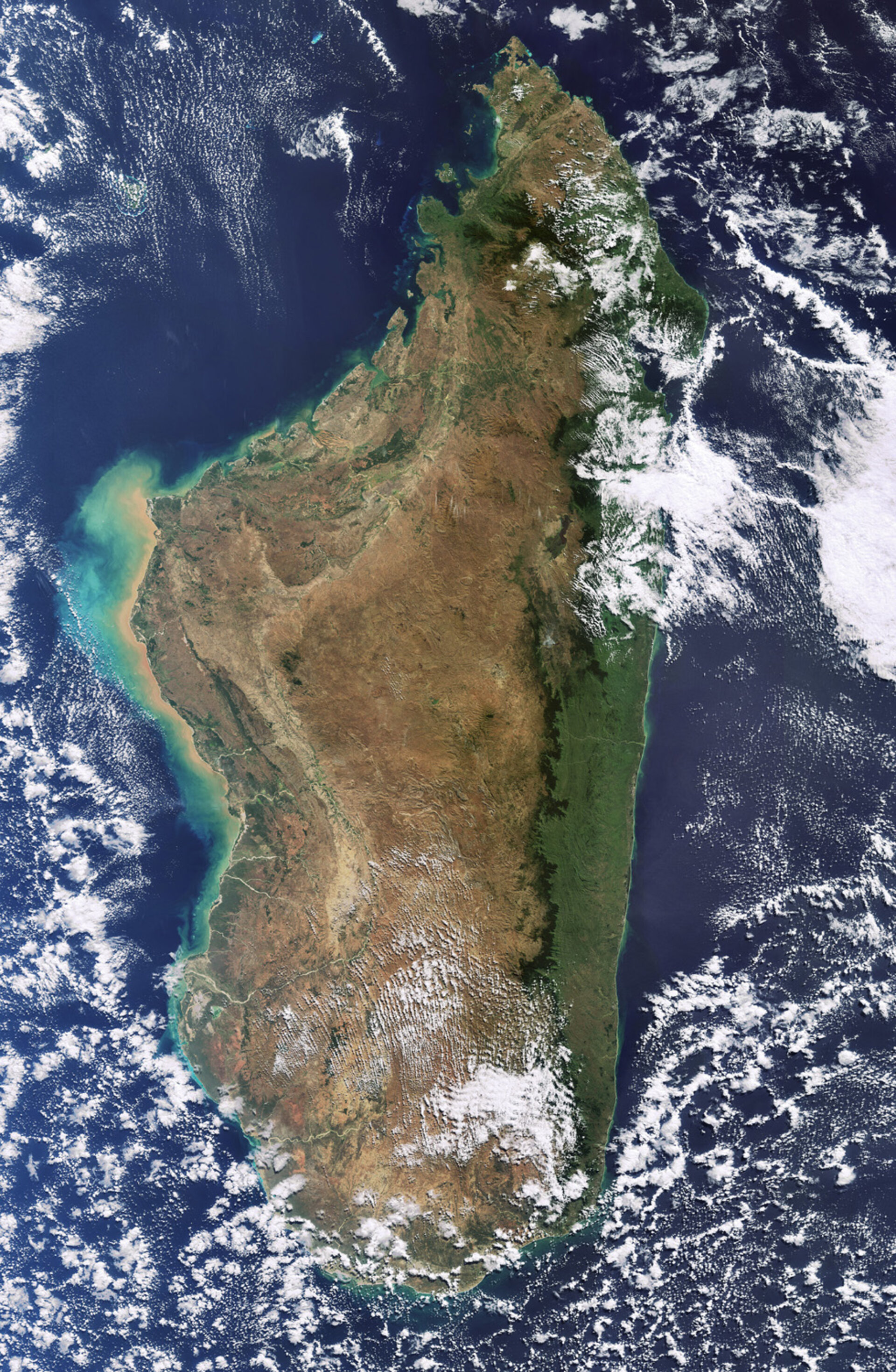
Madagascar, the world’s fourth largest island, is highlighted in this image, acquired by Envisat's Medium Resolution Imaging Spectrometer (MERIS) instrument on 30 June 2009.

The island boasts an extremely diverse terrain with beaches and lagoons along the coasts, high plateaus and mountains in the centre, and rivers, deserts and grasslands spread throughout. Due to the permanently reddish tint of its bare earth, Madagascar has earned the nickname Great Red Island.
Madagascar’s major rivers rise in the highlands near the eastern coast and flow west through valleys to the Mozambique Channel (left). Green and tan swirls along the west coast are sediments being transported in the water.

  • ESA, CC BY-SA 3.0 IGO
  • Observing the Earth
  • Envisat
  • Land use
  • Earth observation image of the week
Madagascar
Applications

Madagascar

Image 3886 views 58 likes
Envisat sees Madagascar
Applications

Envisat sees Madagascar

Image 817 views 4 likes
A virtually cloudless image of Madagascar
Applications

A virtually cloudless image of Madagascar

Image 2728 views 4 likes
Madagascar   - MERIS - 13 August 2003
Applications

Madagascar - MERIS - 13 August 2003

Image 484 views 3 likes
Applications

Earth from Space: Madagascar

Video 00:03:06 1715 views 20 likes