Applications
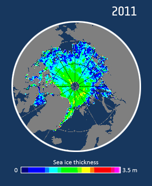
Arctic sea-ice thickness
CryoSat’s exceptionally detailed data have been used to generate this map of sea-ice thickness in the Arctic. Data from January and February 2011 have been used to show the thickness of the ice as it approaches its annual maximum. Thanks to CryoSat’s orbit, ice thickness close to the North Pole can be seen for the first time.