Agency
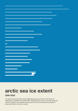
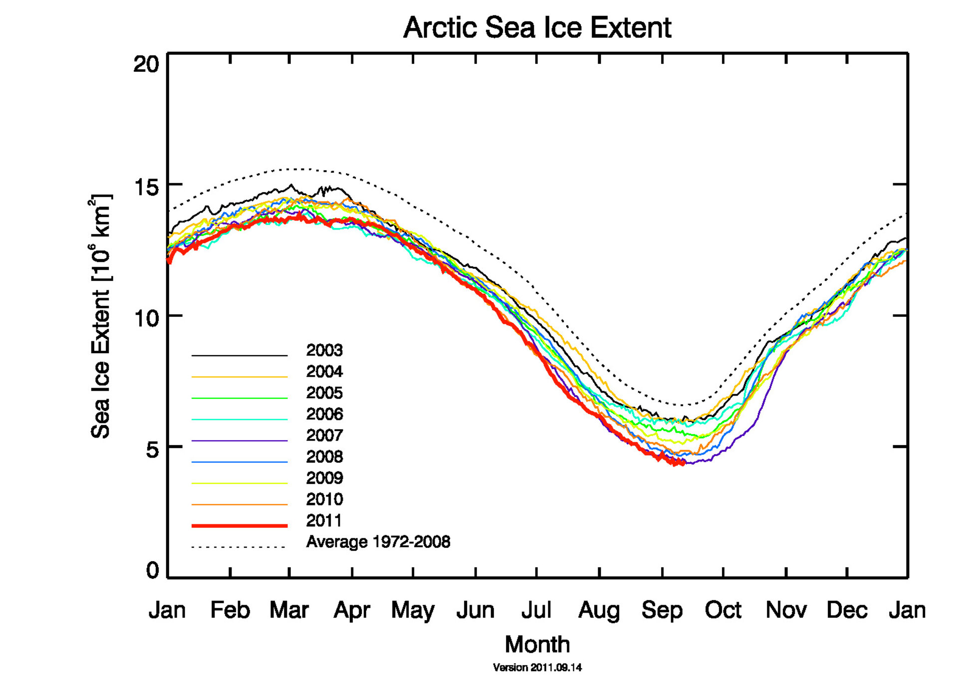
Arctic sea ice since 2003
This graph, based on data from the Advanced Microwave Scanning Radiometer-Earth Observing System (AMSR-E) on NASA’s Aqua satellite, shows the Arctic sea ice extent for each year from 2003 to 2011. The Bremen sea-ice maps are generated as part of their involvement in the ESA-funded project Polar View.