Applications
Mapping for emergency response
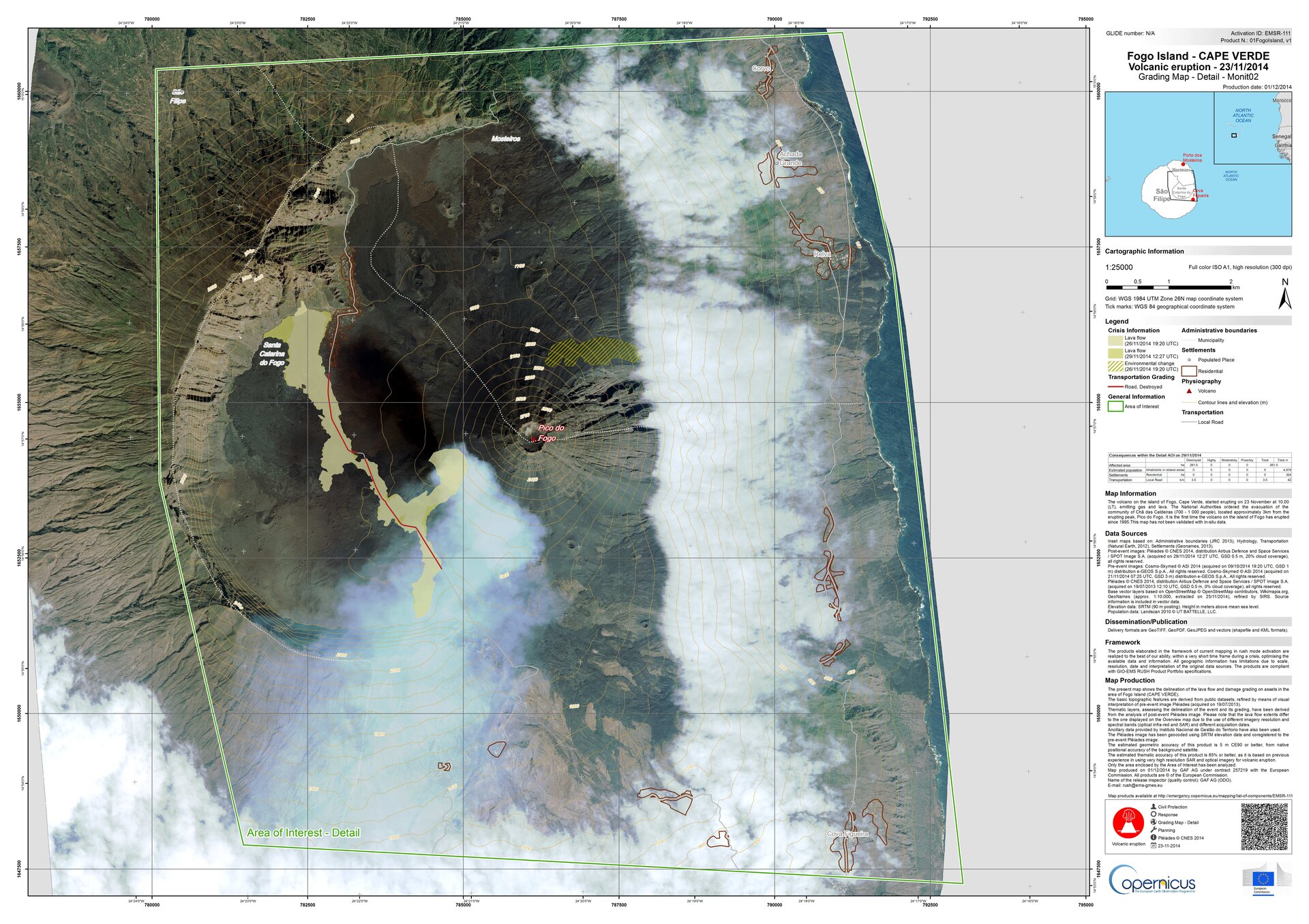
Using satellite imagery, maps like this are created under the Copernicus Emergency Management Service to support impact assessment for many types of hazards.
Using satellite imagery, maps like this are created under the Copernicus Emergency Management Service to support impact assessment for many types of hazards.