Applications
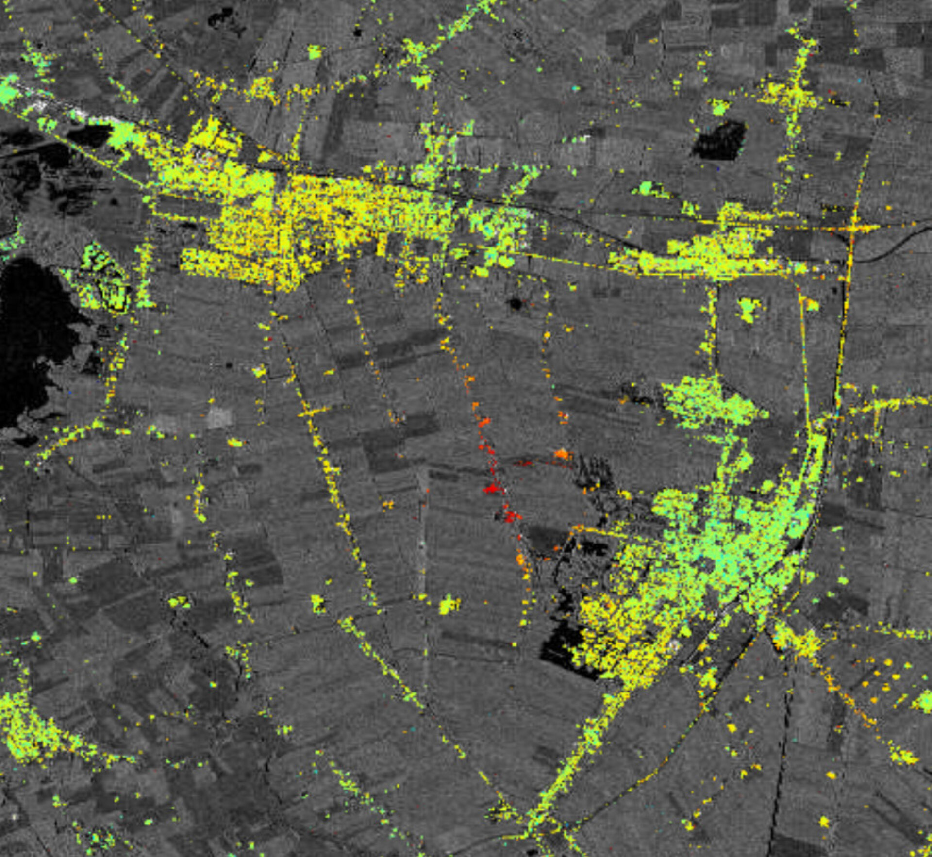
Subsidence from salt mining
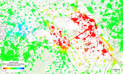
This shows surface deformation resulting from from salt mining activities around Veendam in the province of Groningen in northeast of the Netherlands. The map, which is a zoom-in of a larger map, has been generated using images from the Copernicus Sentinel-1A satellite. Green points show where the land is stable and the orange and red colours indicate subsidence.
Read full story: Mapping that sinking feeling