Applications
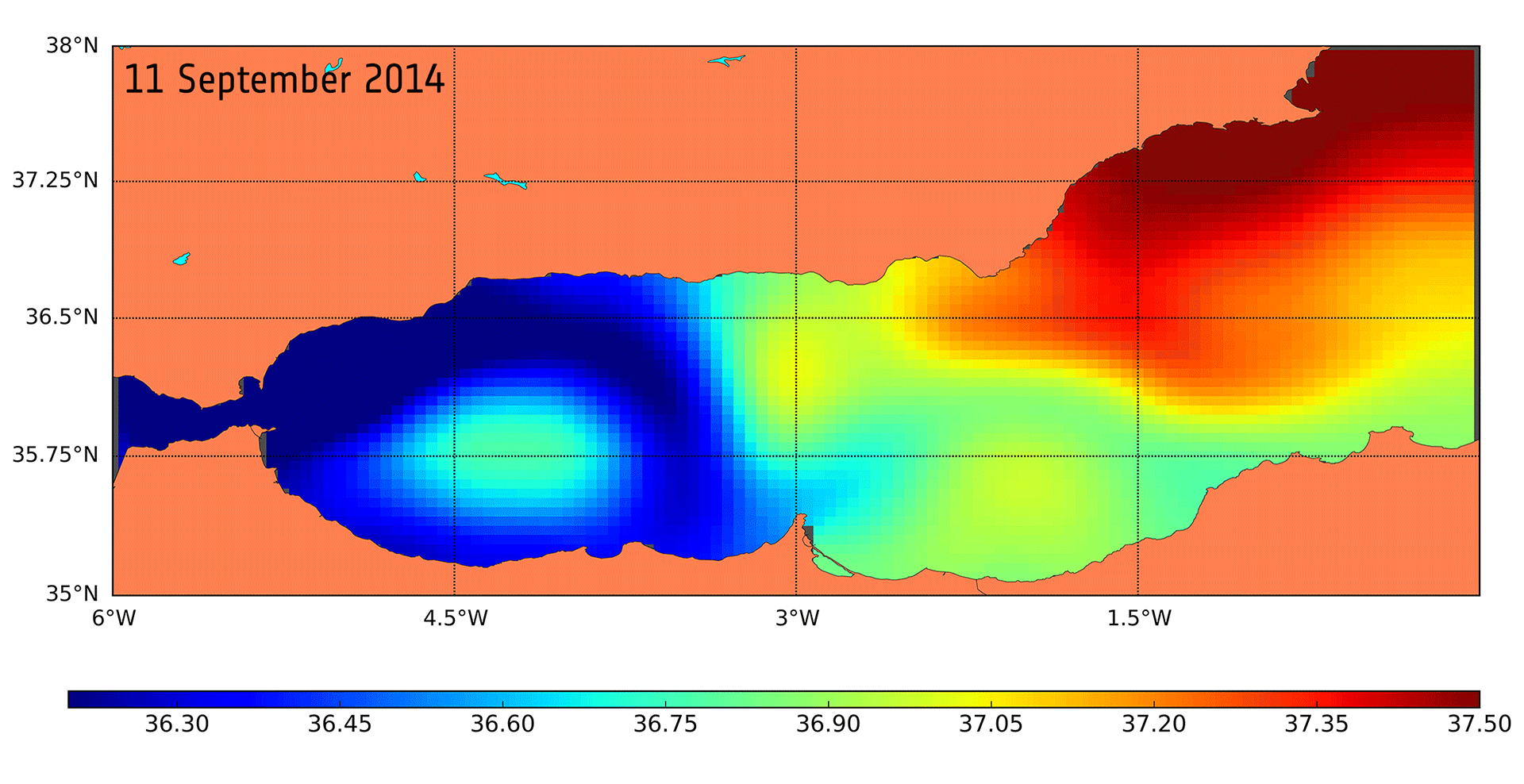
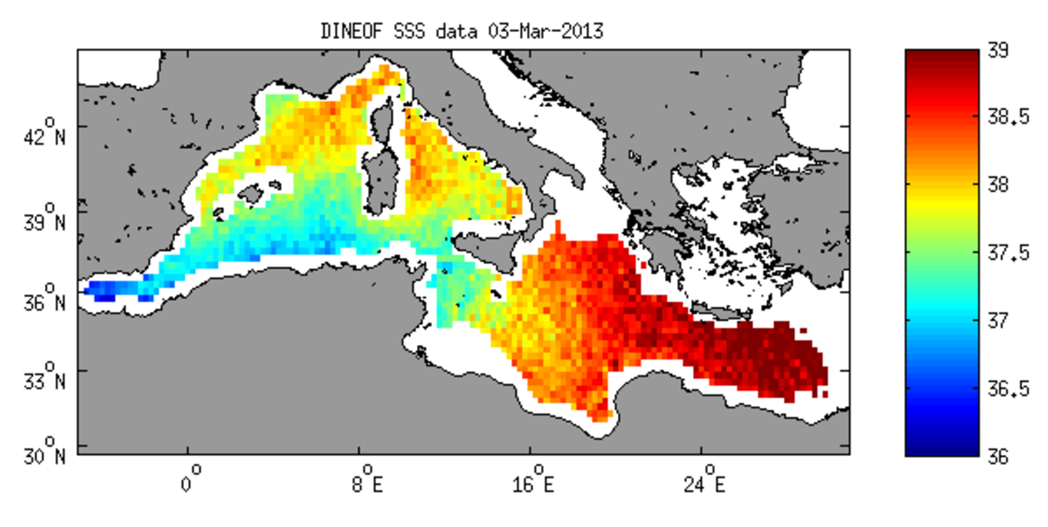
Mediterranean Sea salinity
Thanks to new processing techniques, information from ESA’s SMOS mission can be used to map salinity in the surface waters of the Mediterranean Sea. For example, daily maps can be created using DINEOF, which reduces noise and other sources of contamination. The image, which captures salinity on 3 March 2013, shows the fresher water from the Atlantic Ocean flowing through the Strait of Gibraltar into the Mediterranean Sea.