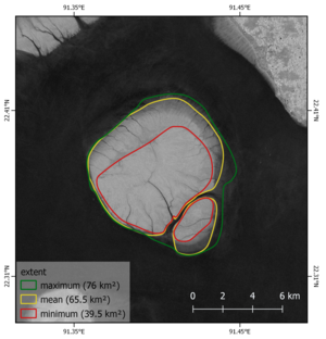
United space in Europe
Barely an island
Applications

Barely an island

29/05/2018 789 views 3 likes 394627 ID
  • HI-RES PNG [2.26 MB]

Thank you for liking

You have already liked this page, you can only like it once!

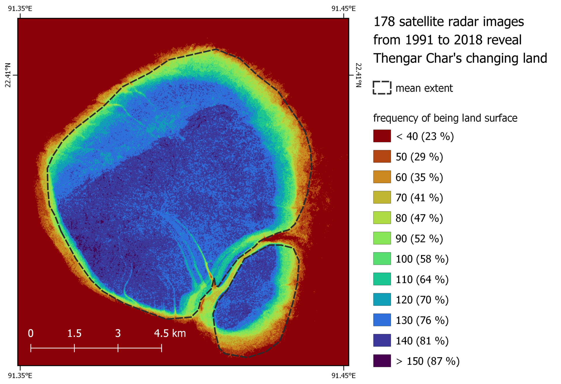
Based on 178 archived satellite radar images from 1991 to 2018, this image shows how often a pixel was identified as land. During this time, the island of Thengar Char mostly varied between 30% and 80% of its mean extent. This shows how vulnerable the island is to flooding.

  • EO4HumEn+
  • Observing the Earth
  • Sentinel-1
  • Copernicus
Thengar Char
Applications

Thengar Char

Image 964 views 3 likes
Sentinel radar view of Greek islands
Applications

Greek islands

Image 2024 views 16 likes
Greenland snow grain and albedo
Applications

Greenland snow grain and albedo

Image 710 views 8 likes
Edgeøya or Edge Island
Applications

Edgeøya or Edge Island

Image 1972 views 11 likes
Island heart
Applications

Island heart

Image 4874 views 77 likes