Applications
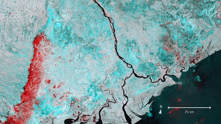
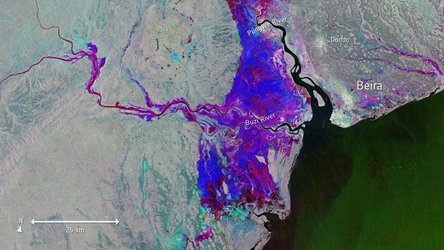
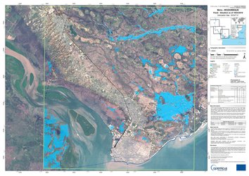
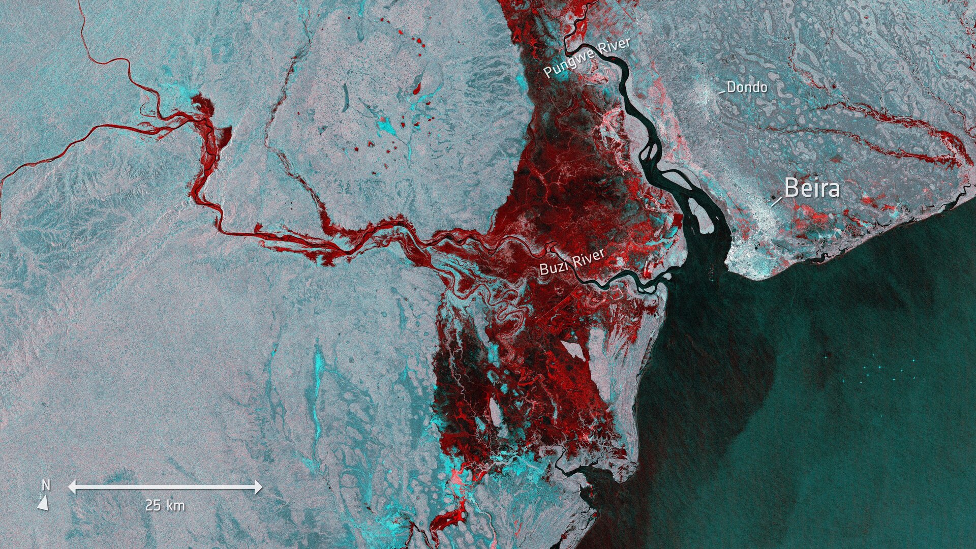
Floods imaged by Copernicus Sentinel-1
Millions of people in Mozambique, Malawi and Zimbabwe are struggling to cope with the aftermath of what could be the southern hemisphere’s worst storm: Cyclone Idai. This image is from Copernicus Sentinel-1 and shows the extent of flooding, depicted in red, around the port town of Beira in Mozambique on 19 March. This mission is also supplying imagery through the Copernicus Emergency Mapping Service to aid relief efforts.