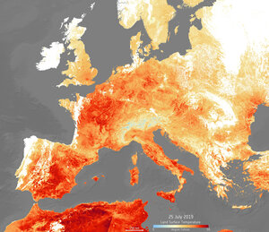
Too hot to handle
An extreme heatwave has hit Europe once again this week, following June's hot spell. High temperatures are expected to peak today, reaching as high as 39—40°C, with Netherlands, Belgium and Germany recording their highest ever temperatures. Paris reached a sweltering 41°C, breaking its previous record in 1947.
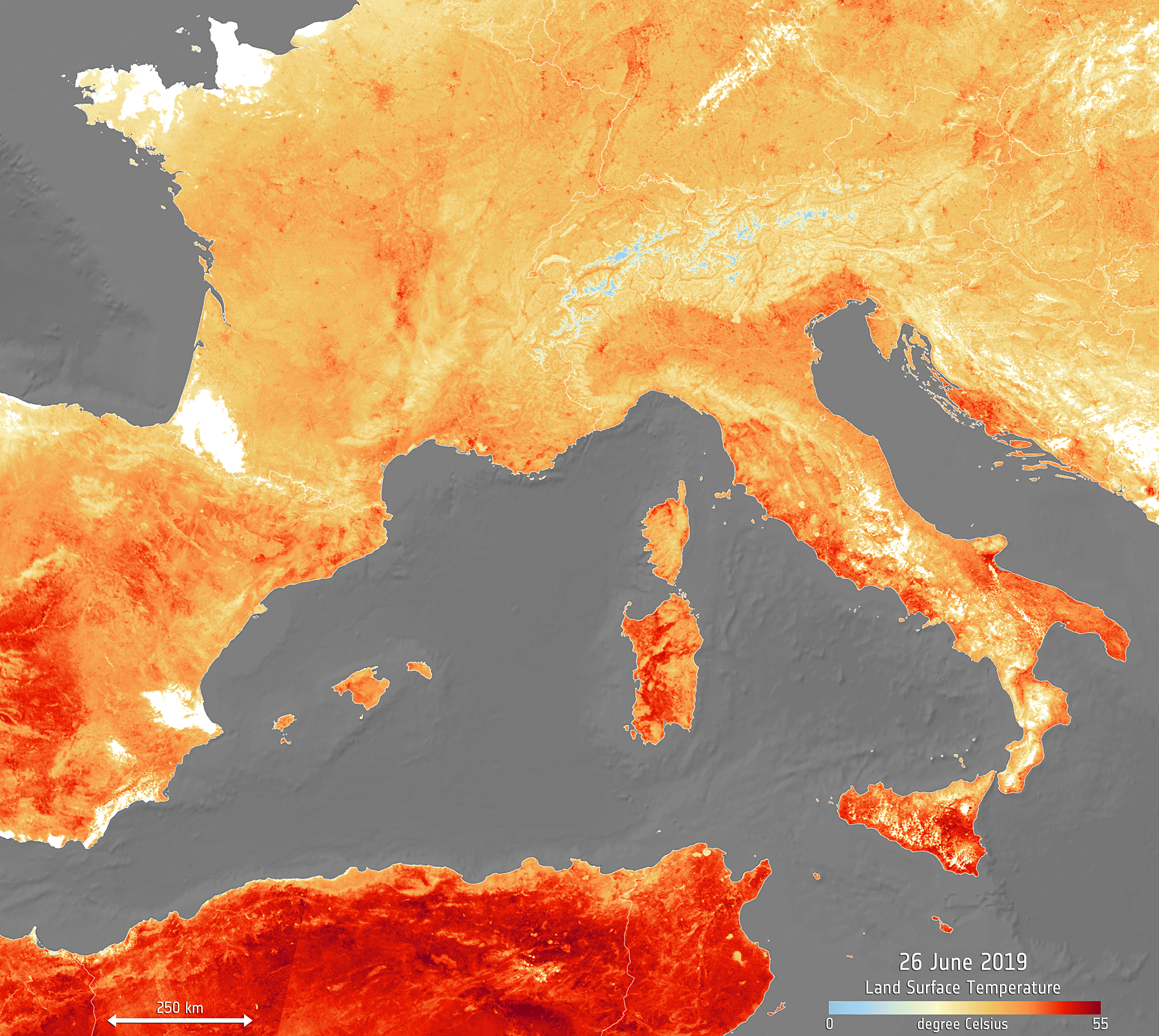
This animation of two images shows the land surface temperature from today 25 July, compared to data recorded during the previous heatwave on 26 June 2019.
The map has been generated using the Copernicus Sentinel-3’s Sea and Land Surface Temperature Radiometer. Whereas weather forecasts use predicted air temperatures, the satellite measures the real amount of energy radiating from Earth – therefore this map better represents the real temperature of the land surface. Clouds are visible in white in the image, while the light blue represent snow-covered areas.
The heatwave in June broke several records for many countries, with France reaching over 45°C for the first time. Germany, Hungary, Poland, Austria, Czech Republic, Slovakia also reached peak temperatures.
In many countries, red heat warnings have been issued, including Italy, Spain and France and civilians are advised to avoid travelling and stay hydrated.