Applications
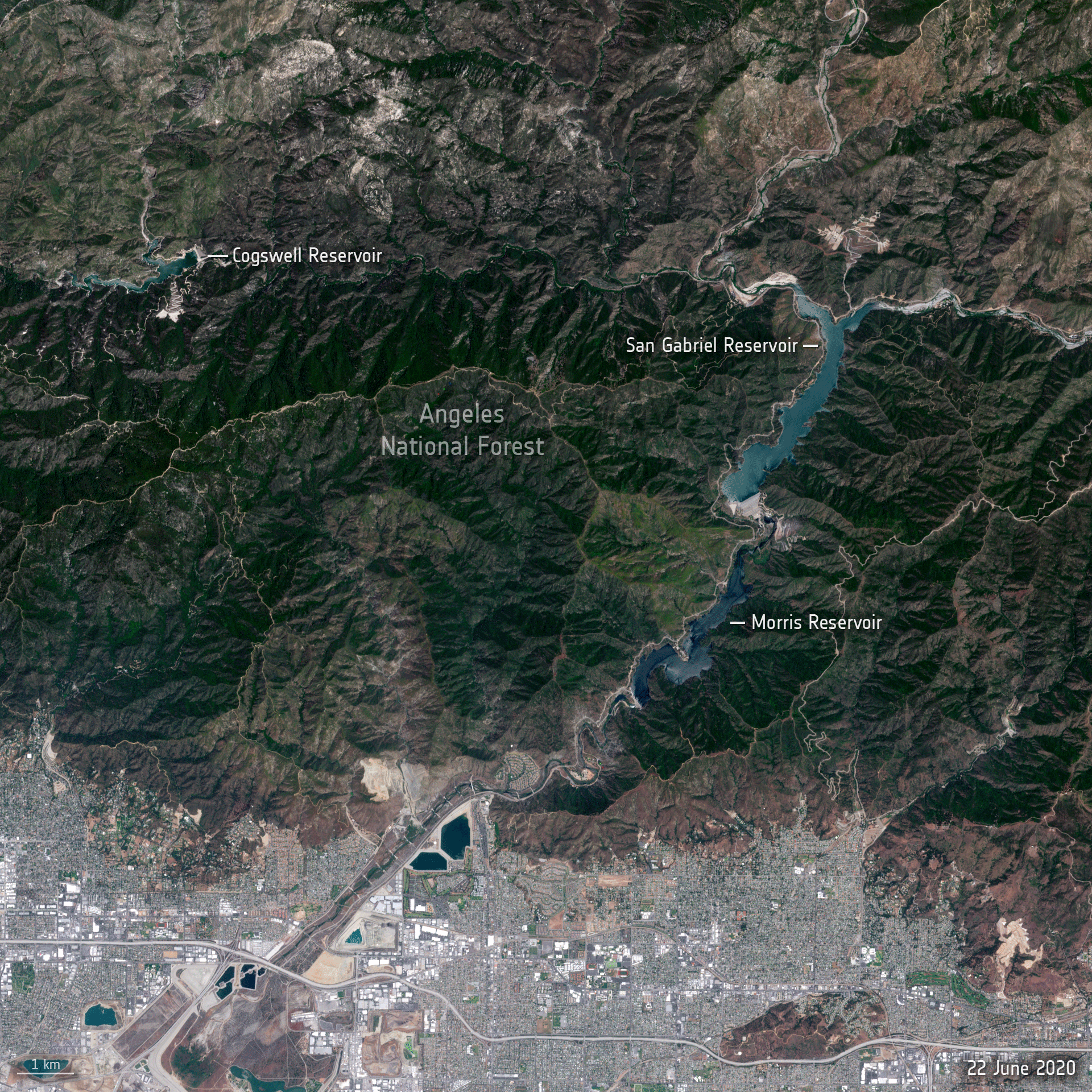
California drought
The Copernicus Sentinel-2 mission brings two images showing the impact of the severe drought affecting the state of California in the United States. The images cover the area over Angeles National Forest at the outskirts of the Greater Los Angeles metropolitan area and depict changes in water levels of several important water reservoirs as well as the state of the forest in June 2020 and 2021.
Copernicus Sentinel-2 is a two-satellite mission. Each satellite carries a high-resolution camera that images Earth’s surface in 13 spectral bands. The mission is mostly used to track changes in the way land is being used and to monitor the health of vegetation.