Applications
Protecting areas of the Atlantic Ocean from human activity
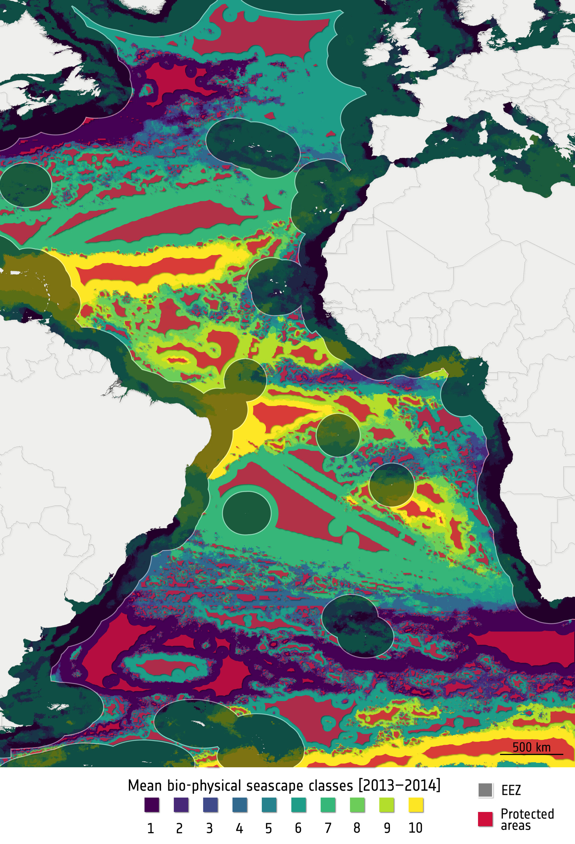
This image shows potential protected areas (representing 30% of individual seascapes). It also shows economic exclusive zones (EEZ), which are shaded. EEZs are areas of open ocean, beyond any nation’s territorial sea, within which a nation has sovereign rights and jurisdiction. In this map, seascapes are categorised from 1 to 10, according to their bio-physical characteristics, where seascapes are a proxy for biodiversity. The characteristics of seascapes were defined according to satellite datasets.
Read full story: Protecting ocean biodiversity with satellite data