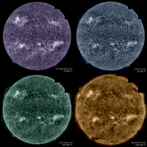
SPICE sees the Sun's south pole
The Spectral Imaging of the Coronal Environment (SPICE) instrument on the ESA-led Solar Orbiter spacecraft got its first good look at the Sun's south pole in March 2025.
Here we compare two of SPICE's views of the Sun's south pole, both based on measurements of the light sent out by charged particles (ions) of carbon at a temperature of 32 000 °C. These ions live in the transition region, a thin layer around the Sun where the temperature rapidly increases from around 10 000 °C to hundreds of thousands of degrees.
The left image shows an intensity map, revealing the locations of clumps of carbon ions. The right image shows a velocity map, where blue and red indicate how fast the carbon ions are moving towards and away from the Solar Orbiter spacecraft, respectively. Darker blue and red patches are related to plasma flowing faster due to small plumes or jets.
The data shown here were recorded on 22–23 March 2025, when Solar Orbiter was facing the Sun from an angle of 17° below the solar equator. The images are each composed of three observations that were subsequently stitched together.
Solar Orbiter is a space mission of international collaboration between ESA and NASA. The Spectral Imaging of the Coronal Environment (SPICE) instrument is a European-led facility instrument, led by the Institut d'Astrophysique Spatiale (IAS) in Paris, France.
[Image description: A comparison of two images of the Sun's south pole, captured by Solar Orbiter’s SPICE instrument. The left image is an intensity map of the Sun’s south pole, highlighting the location of clumps of carbon ions above the Sun's surface. A bright, glowing arc curves along the bottom of the image. Above the arc, the image is dotted with smaller bright pastel-yellow spots and streaks, set against a darker golden-yellow background, representing areas of varying density. The right image is a velocity map of the Sun’s south pole. The map is filled with red and blue colours, which represent motion. Red areas show carbon ions moving away from the observer, while blue areas show where these ions move towards the observer. The background is black, making the coloured regions stand out clearly. Curved lines and a faint grid overlay both images, indicating lines of solar latitude and longitude.]

SPICE sees movement at the Sun's south pole

Solar Orbiter's world-first views of the Sun's south pole

Solar Orbiter’s SPICE will help reveal the mysteries…

Taking the Sun’s temperature