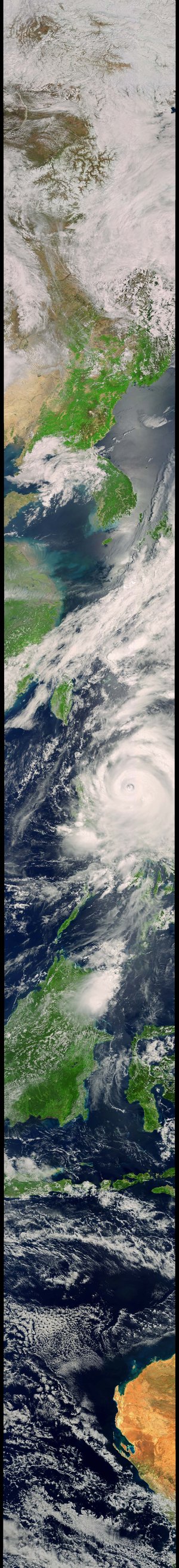
Typhoon Ragasa seen from space
Captured on 24 September 2025 by EUMETSAT’s MetOp-B satellite, this image shows Typhoon Ragasa swirling south of Hong Kong. Days earlier, Ragasa struck the northern Philippines with winds reaching 295 km/h, causing evacuations, power cuts and widespread disruption. Having since weakened from super typhoon status, it has made landfall in southern China and moved west-northwest.
[Image Description: Satellite image showing Typhoon Ragasa over the South China Sea, with a clear eye south of Hong Kong. The storm’s spiral bands extend across southern China, Taiwan and the northern Philippines. The surrounding landmasses of Vietnam, Laos, Cambodia and Thailand are visible, with cloud cover stretching across the region. Labels mark Hong Kong, Taiwan, the Gulf of Tonkin, and Panultan Island in the northern Philippines.]