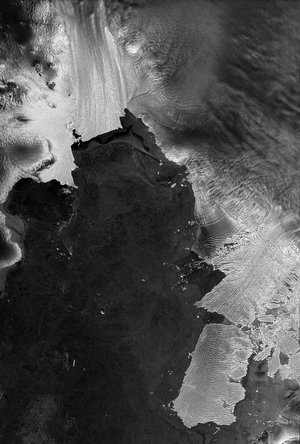
Thwaites and Pine Island glaciers by Sentinel-1D
This image is one of the first to be captured by the Copernicus Sentinel-1D satellite, which carries a 12 m-long synthetic aperture radar (SAR) instrument. It was captured on the night of 6 November (European time) and the data was then transmitted from the satellite to the Matera ground station, in Italy. All this was done within 50 hours of launch, which is likely to be the shortest time from launch to data delivery for a radar-based Earth observation satellite.
Radar instruments are particularly useful for imaging Earth’s surface through rain and cloud, as well as in darkness, making radar an ideal remote-sensing tool for observing polar regions. The satellite also carries an Automatic Identification System (AIS) instrument – enabling the mission to improve detection and tracking of ships over maritime zones.
The Thwaites glacier, and the adjacent Pine Island glacier, are located west of the Antarctic Peninsula. Both are vulnerable to climate change. Thwaites is one of the most unstable glaciers in Antarctica and is at risk of rapid retreat. The details shown in this image from Sentinel-1D remind us of the fragility of glaciers in the Antarctic. And since 2025 is the United Nation’s International Year of Glaciers' Preservation, it is timely to see this image, captured on 6 November 2025.
This image uses multiple radar polarisations to capture enhanced data on the landscape. In this image, the sea ice in the water is visible in tones of purple or violet, while the glacier appears white.
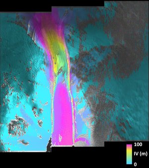
Radar polarisation refers to the orientation of the radar wave’s electric field, which often moves either horizontally or vertically in relation to the ground. This affects how the radar signal interacts with the surface and therefore determines the data that can be collected about the physical characteristics of the surface. Using multiple polarisations helps analysts to study and better distinguish surface features. When several polarisation signals are combined, each can be assigned to either a red, green or blue light channel, producing a colourful image that highlights different surface features far beyond what is possible with single polarisation data alone.
Read full story: Sentinel-1D delivers first images: from Antarctica to Bremen