CryoSat views a geomagnetic storm
Over a few days in January 2026, a particularly strong X-class solar flare caused a geomagnetic storm in Earth’s atmosphere, with some of the most intense radiation storms on record. The cause was an eruption on the Sun’s surface, which released high energy particles that reached Earth within 25 hours. ESA’s ice mission, CryoSat had just received an important software update, enabling the mission to not only monitor polar ice sheets and sea ice, but to also provide scientific data on Earth’s magnetic field.
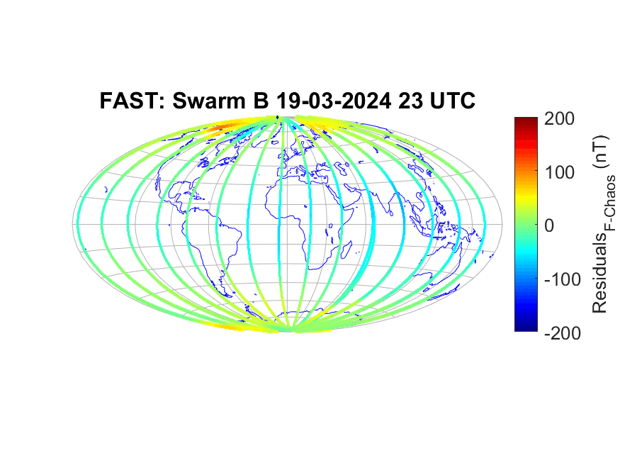
This image, consisting of data from CryoSat, together with data from two of Swarm’s satellites, as well as data from the Macau Science Satellite-1 (MMS-1) and NASA’s GRACE-FO satellite, shows the intensity of the disturbance in Earth’s magnetic field, caused by the solar flare. The colours on the map represent intensity extremes, with the dark orange indicating where Earth’s magnetic field increased in strength, while the dark blue indicates where the magnetic field got weaker. The storm was at its most powerful just after mid-day on 20 January.
The lines indicate satellite tracks and dots are points of ground observation.
Read full story: How does an ice satellite detect a geomagnetic storm?