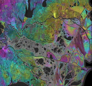
Six-day, one-day and double-difference interferograms of Evans Ice Stream
Thirty years after the European Space Agency first demonstrated the power of flying two satellites in very close formation, the concept was recently recreated. By temporarily positioning two Copernicus Sentinel-1 radar satellites to replicate the pioneering ERS-1–ERS-2 ‘tandem mission’, ESA achieved one-day repeat imaging of the same Antarctic region. The results once again demonstrate how this approach can be used to measure glacier motion and pinpoint the critical grounding line with exceptional precision.
The image shows Evans Ice Stream – a six-day Sentinel-1A–Sentinel-1C interferogram (left), a one-day Sentinel-1C–Sentinel-1D interferogram (centre), and a Sentinel-1C–Sentinel-1D double-difference interferogram (right). The shorter repeat-pass interval and double-difference processing clearly reveal tidal deformation zones and shear zones, demonstrating the enhanced capability for mapping ice dynamics, shear zones and the grounding line.
Read full story: Satellites in tandem reveal 30 years of Antarctic ice flow