Surface water over South America from HydroGNSS
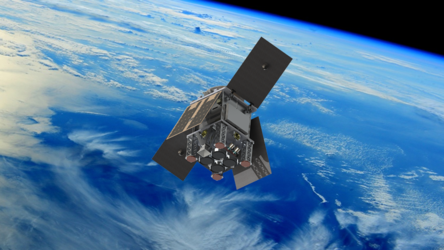
The European Space Agency's two-satellite HydroGNSS Scout mission has completed commissioning and is now in full scientific operations. Following extensive testing and validation of the satellites, instruments and ground segment, HydroGNSS data are now freely available to users worldwide, opening new opportunities to advance our understanding of water availability and the impacts of climate change on Earth's water cycle.
The images demonstrate HydroGNSS’ ability to detect surface water at high resolution, including beneath vegetation canopies. The left image shows measurements from HydroGNSS’ coherent channel, which uses the behaviour of reflected GNSS signals to identify water surfaces. The data are collected along satellite tracks at 300 m resolution, with observations from both satellites combined over time to build a more complete picture.
The right image shows a global flood map generated using C-band radar data from Copernicus Sentinel-1 over the same region. Unlike GNSS-R, radar signals can have difficulty detecting water beneath dense vegetation. HydroGNSS therefore provides a new way to observe wetlands hidden below forest canopies, helping improve estimates of these important ecosystems and their role in the global carbon cycle.
Read full story: HydroGNSS data open for new insights into Earth’s water