United space in Europe
Applications

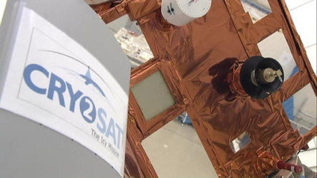
CryoSat-2 the ground truth

25/02/2010 1330 views 1 likes 249334 ID 00:03:03
English
  • MP4 [21.46 MB]

Thank you for liking

You have already liked this page, you can only like it once!

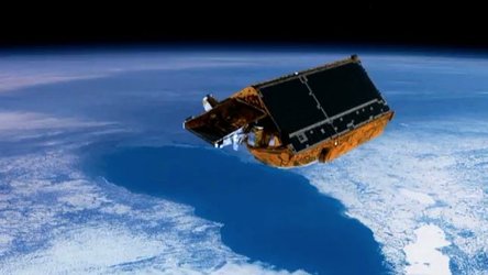
For the first time a satellite is to measure with the precision of a few centimetres the thickness, extent and changes of the polar ice caps. That the glaciers, continental and sea ice is now melting at an alarming rate is undisputed but until now no precise data has been available.

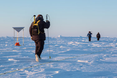
ESAs CryoSat-2 spacecraft, due to be launched from Baïkonur in a few weeks, will be providing that information, valuable to climatologists throughout the world. The mission will also be relying on the ground truth measurements obtained in the field which help to validate the data obtained by the spacecraft.

This A & B-roll explains the scientific objectives of the mission and associated campaigns on the ground. It includes interviews with CryoSat-2 project manager Richard Francis, lead scientist Duncan Wingham, Malcolm Davidson, ground campaign manager, Johnny Johannessen from the Nansen Environmental and Remote Sensing Centre, Bergen, Volker Liebig, ESA Director of Earth Observation and his colleague Stephen Briggs, Head of Earth Observation Science.

  • ESA
  • VNR
  • Observing the Earth
  • CryoSat CryoSat-2
  • Cryosat 2 Satellite Cryosat Radar Altimeter
  • University College London
  • Drilling Flying Investigating Measuring Monitoring Observing
  • 3D models 3D view Altimeter Altimetry Animations Arctic Boat Climate Change Cryovex Earth Earth observation Glaciers Ice cap Ice sheets Ice thickness Icebergs Measurement Ocean Ocean currents Polar orbit Poles Scientist Sea-ice Ships
CryoSat-2, ESA's Ice Mission
Applications

CryoSat-2 Mission Overview

Video 00:03:04 835 views 3 likes
CryoSat-2, ESA's Ice Mission
Applications

CryoSat-2 VNR

Video 00:03:59 2085 views 3 likes
Trekking out for CryoSat
Applications

Trekking out for CryoSat

Image 833 views 16 likes
Grounding line
Applications

Grounding line

Image 1087 views 8 likes
Sea-level detail from CryoSat
Applications

Sea-level detail from CryoSat

Image 1591 views 11 likes