ESAEducationHomeTempo e climaCambiamento globaleCatastrofi naturali
   
Inondazioni
Salonicco (Grecia)
Terremoti
IntroduzioneTerremoto di Izmit
Uragani
MareggiateL'uragano Katrina
Vulcani
IntroduzioneCintura vulcanica andinaEtnaNyiragongo e Nyamuragira
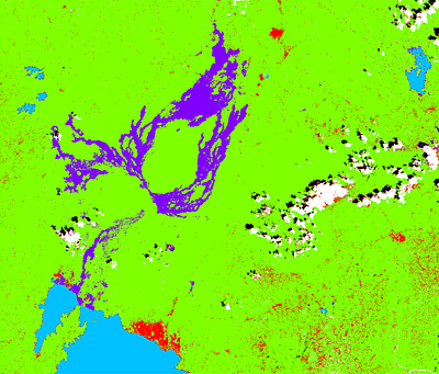
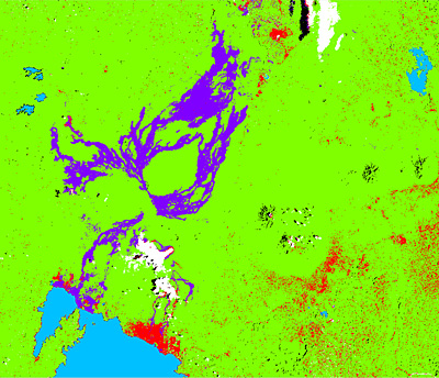
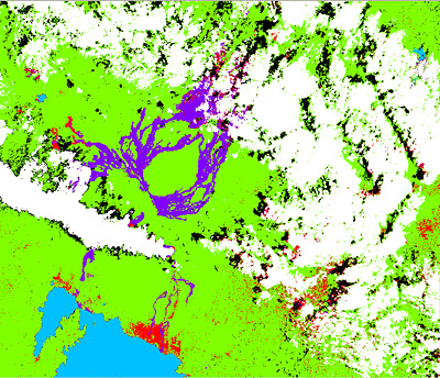


Article Images
Esercizio 3: Rilevamento e monitoraggio multitemporale dei cambiamenti


New lava flood
Download:
 HI-RES JPEG (Size: 193 kb)
Training fields of 2001 that have to be modified for 2003 (new lava flow, plume, cloud).
 
 
Plume
Download:
 HI-RES JPEG (Size: 180 kb)
Training fields of 2001 that have to be modified for 2003 (new lava flow, plume, cloud).
 
 
Cloud
Download:
 HI-RES JPEG (Size: 103 kb)
Training fields of 2001 that have to be modified for 2003 (new lava flow, plume, cloud).
 
 
Download:
 HI-RES JPEG (Size: 672 kb)
The supervised classification result for the Landsat 2001 image was manually re-coloured with colours that are easier to distinguish and associate with land cover features.
 
 
Download:
 HI-RES JPEG (Size: 693 kb)
Supervised classification of 31 January 2003 Landat image. The volcanic plume was classified as clouds, but unfortunately it overlays part of the new lava of the 2001 eruption.
 
 
Download:
 HI-RES JPEG (Size: 878 kb)
Supervised classification image of 15 January 2003. The image is very cloudy. Lava of the 2001 eruption can clearly be seen.


Nyiragongo and Nyamuragira
Introduction
Change detection and hazard assessment
Worksheet introductionExercise 1: Exploring and learning about the volcanoExercise 2: Lava Detection using Supervised ClassificationExercise 3: Multitemporal Change Detection and Monitoring
Eduspace - Download
Nyiragongo_Landsat.zip
Eduspace - Software
LEOWorks 3LEOWorks 3 Tutorial


   Copyright 2000 - 2014 © European Space Agency. All rights reserved.