ESA
Education
Hauptseite
Wetter und Klima
Globale Veränderungen
Naturkatastrophen
Küstenveränderung
Donaudelta
Ölpest
Entwaldung
Bardia-Nationalpark
Kongobecken
Kameng-Sonitpur
Kilimanjaro
Rondonia
Shillong und Guwahati
Eis
Antarctica 2003
Gletscher und Klimawandel
Rückzug der Gletscher in den Alpen
Gletscherbewegung
Gletscherüber
wachung im Himalaya
Fernerkundung von Eis und Schnee
Untersuchung von Gletschern mit Radaraufnahmen
Urbanisierung
Cordoba
Kairo
Kathmandu
Himalaya
Kathmandu-Tal
Lagos
Vegetation
Annapurna-Naturschutzgebiet
Verschollen in den Anden
Ngorongoro-Naturschutzgebiet
Nigerbinnendelta
Vegetation in Südamerika
Suche
Article Images
Analyse von Satellitenbilder - Teil 3
Zurück zum Artikel
Download:
HI-RES JPEG
(Size:
11 kb
)
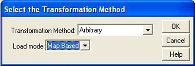
Kameng-Sonitpur Elephant Reserve – Selection of transformation method for opening of the GIS theme showing the forest boundaries in 1994.
Zurück zum Artikel
Download:
HI-RES BMP
(Size:
253 kb
)
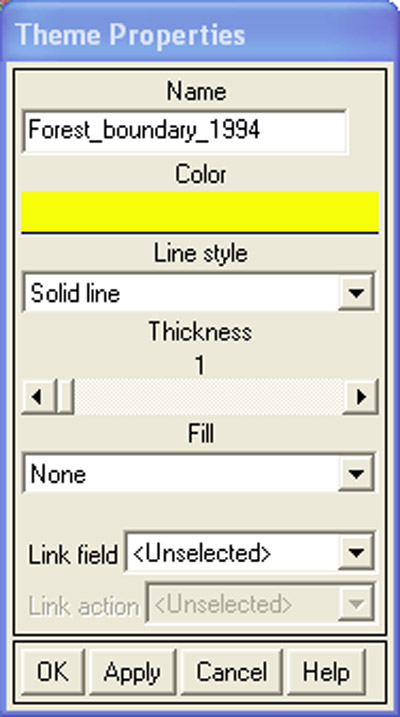
Kameng-Sonitpur Elephant Reserve – Select a colour for the forest boundaries in the Theme Properties window.
Zurück zum Artikel
Download:
HI-RES BMP
(Size:
619 kb
)
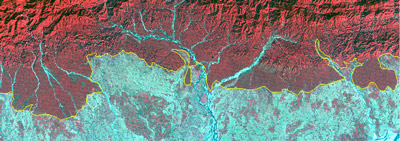
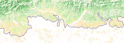
Kameng-Sonitpur Elephant Reserve – False colour combination of 1994 image with forest boundaries.
Zurück zum Artikel
Download:
HI-RES BMP
(Size:
622 kb
)
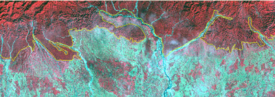
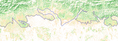
Kameng-Sonitpur Elephant Reserve – False colour combination of 2003 image with forest boundaries.
Zurück zum Artikel
Download:
HI-RES BMP
(Size:
619 kb
)
Kameng-Sonitpur Elephant Reserve – NDVI image of 1994 with forest boundaries.
Zurück zum Artikel
Download:
HI-RES BMP
(Size:
805 kb
)
Kameng-Sonitpur Elephant Reserve – NDVI image of 2003 with forest boundaries.
Kameng-Sonitpur-Elefantenreservat
Einführung
Kameng-Sonitpur-Elefantenreservat
Der Asiatische Elefant
Konflikte zwischen Elefanten und Menschen
Übungen
Einführung
Erstellung von Landkarten auf Papier und der Untersuchung des KSER
Analyse von Satellitenbilder
Eduspace - Software
LEOWorks 3
ArcExplorer
Eduspace - Download
ks_papermap.zip
ks_satelliteimg.zip
Arbeitsmaterial
Mehr information
Copyright 2000 - 2014 © European Space Agency. All rights reserved.