ESA
Education
Home
Weather and Climate
Global Change
Natural Disasters
Coastal change
Danube Delta change detection
Oil spills
Deforestation
Bardia National Park
Congo River Basin
Kameng-Sonitpur Elephant Reserve
Kilimanjaro
Rondonia
Shillong and Guwahati
Ice
Antarctica 2003
Climate change and glaciers
Glacier analysis using radar imagery
Glacial retreat in the Alps
Glacier Ice Flow
Monitoring of glaciers in the Himalayas
Remote sensing of ice and snow
Urbanisation
Cairo
City of Kathmandu
Córdoba
Himalayas
Kathmandu Valley
Lagos
Vegetation
Annapurna Conservation Area
Lost in the Andes
Ngorongoro Conservation Area
Niger Inland Delta
Vegetation in South America
Search
Article Images
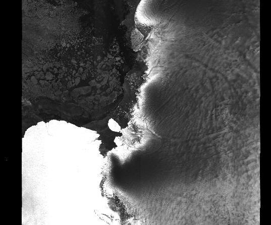
Exercise 2 - Guide the icebreaker through the ice using images and maps - Continued
Back to article
Download:
HI-RES JPEG
(Size:
217 kb
)
Overview map to plot the corner coordinates of the radar image (east).
Credits: Eduspace
Back to article
Download:
HI-RES JPEG
(Size:
206 kb
)
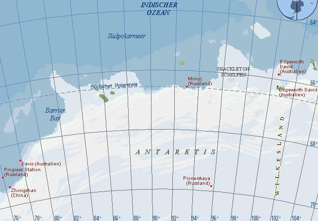
Overview map to plot the corner coordinates of the radar image (west).
Credits: Eduspace
Back to article
Download:
HI-RES JPEG
(Size:
50 kb
)
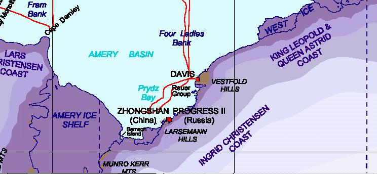
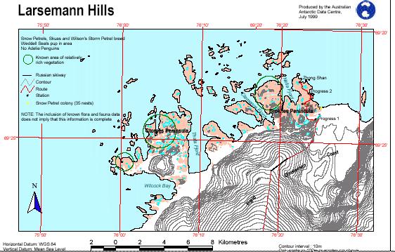
This map serves to get a good orientation of the area.
Credits: Eduspace
Back to article
Download:
HI-RES JPEG
(Size:
45 kb
)
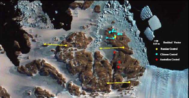
An aerial photo from the possible desembarking area.
Credits: Eduspace
Antarctica 2003 expedition
Introduction
Background
Exercises
Introduction
Exercise 1 - Accompany a classmate
Exercise 2 - Guide the icebreaker through the ice using images and maps
Exercise 3 - Guide the icebreaker through the ice using a computer
Exercise 4 - Help, the icebreaker is stuck!
Links
Australian Antarctic Division
Maps Larsemann Hills
Davis station - webcam
Eduspace - Software
LEOWorks 3
Eduspace - Download
ant2003_ex03.jpg
ant2003_ex08.jpg
ant2003_ex09.jpg
ant2003_ex10.jpg
ant2003_ex11.jpg
ant2003_ex12.jpg
ant2003_ex03.txt
Copyright 2000 - 2014 © European Space Agency. All rights reserved.


