Applications
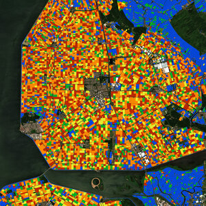
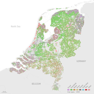
Crop map
Crop-type map of the Netherlands based on a time series of 2017 data during the growing season from the Copernicus Sentinel-1 and Sentinel-2 missions. This kind of information is now being used in the EU’s Common Agricultural Policy to help monitor crop diversification. This is where, in order to be eligible for CAP payments, farmers have to grow a variety of crops, depending on the size of their farm.
Click on the box in the lower-right corner to view this image at its full resolution directly in your browser.