Agency
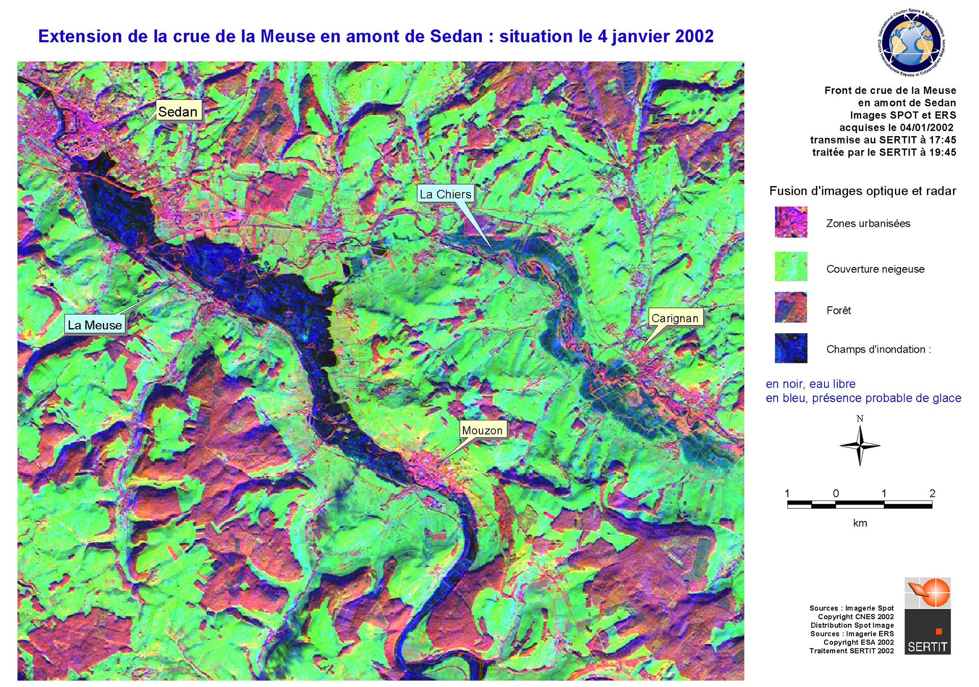
Combined optical and radar satellite view of the Meuse River flood
This 4 Janaury 2002 image combines optical and radar views of the Meuse River flooding Sedan, merging SPOT and ERS imagery. Radar has an enhanced sensitivity to water-logged areas. This image was produced by SERTIT within the framework of an ESA-backed project, aiming at making similar products routinely available for civil protection purposes across France's Eastern defence zone.