Agency
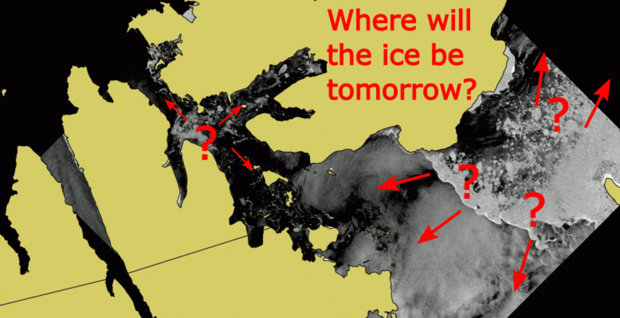
Drift+Noise Polar Services: where will the ice be tomorrow?
The ESA Kick-start project Predictive Ice Images (or PRIIMA) aims at combining high-resolution satellite images with lower-resolution operational sea-ice models. In other words: PRIIMA will deliver ice forecasts with the resolution of a satellite radar image, as if the satellite recording of tomorrow would be available already today.
More about PRIIMA here.