United space in Europe
Applications

GOCE: Geoid

22/03/2011 11527 views 20 likes 183182 ID 00:04:33
English
  • MP4 [34.08 MB]

Thank you for liking

You have already liked this page, you can only like it once!

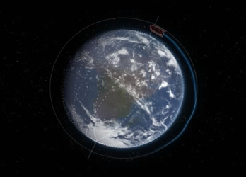
Launched on 17 March 2009, ESA's Gravity field and steady-state Ocean Circulation Explorer (GOCE) is bringing about a whole new level of understanding of one of Earth's most fundamental forces of nature: the gravity field. Dubbed the 'Formula 1' of satellites, GOCE is mapping Earth's gravity field in unprecedented detail.

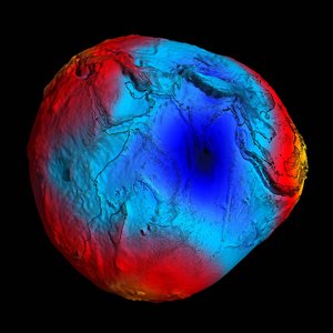
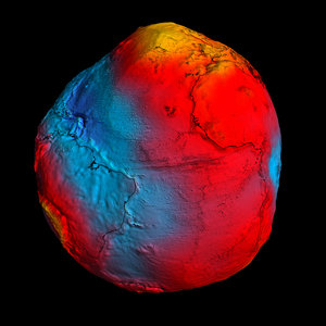
This has given rise to a unique model of the 'geoid', which is the surface of an hypothetical global ocean in the absence of tides and currents, shaped only by gravity. It is a crucial reference for measuring ocean circulation and sea-level change, which are affected by climate change.

The colours in the image represent deviations in height ( -100 m to + 100 m) from an ideal geoid. The blue colours represent low values and the reds/yellows represent high values.

See also: Earth's gravity revealed in unprecedented detail

  • ESA
  • Documentary
  • Observing the Earth
  • GOCE
  • Geoid Gravitational field
2011 GOCE geoid
Applications

2011 GOCE geoid

Image 12542 views 45 likes
The Earth's gravity field (geoid) as it will be seen by GOCE
Applications

The Earth's gravity field (geoid) as it will be seen by GOCE

Image 13553 views 58 likes
New GOCE geoid
Applications

New GOCE geoid

Image 22446 views 111 likes
GOCE data products
Applications

GOCE data products

Image 1793 views 7 likes
GOCE - ESA's gravity mission
Applications

GOCE

Video 00:07:40 4173 views 6 likes